Dafeng geodata
Dafeng (Xinjiang) is a seat of a fourth-order administrative division; located in China in Asia/Urumqi (GMT+6) time zone. In our database, there are 1268 cities with bigger population. Compared to other cities in China, 93% of cities are located further ↓South; 98.2% of cities are located further →East and 75.7% of cities have lower elevation than Dafeng. Note1


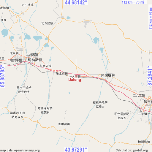
Dafeng GPS coordinates[2]
44° 10' 45.552" North, 86° 35' 27.492" East
| Map corner | latitude | longitude |
|---|---|---|
| Upper-left | 44.68142°, | 85.88785° |
| Center: | 44.17932°, | 86.59097° |
| Lower-right: | 43.67291°, | 87.2941° |
| Map W x H: | 112.1×112.1 km | = 69.7×69.7mi |
| max Lat: | 53.31946° ⇑7% North |
| Dafeng: | 44.17932° |
| min Lat: | ⇓93% South 18.22056° |
| min Long | Dafeng | max Long |
| 75.07348° | 86.59097° | 134.28917° |
| W 1.8%⇐ | ⇒98.2% E |
Elevation
Elevation of Dafeng is 539 m = 1768 ft, and this is 54.2 m = 178 ft above average elevation for this country.
| Max E: |
5622 m = 18445 ft | 24.3% |
| Dafeng | 539 m 1768 ft | |
| Avg. | 484.8 m = 1591 ft | |
Min E: |
-3 m = -10 ft | 75.7% |
See also: China elevation on elevation.city.
Geographical zone
Dafeng is located in North temperate zone (between Tropic of Cancer and the Arctic Circle). Distance of this Northern Tropic circle is 2306.4 km =1433.1 mi to South.| Distance of | km | miles | from Dafeng |
|---|---|---|---|
| North Pole | 5094.8 | 3165.8 | to North |
| Arctic Circle | 2488.9 | 1546.5 | to North |
| Tropic Cancer | 2306.4 | 1433.1 | to South |
| Equator | 4912.3 | 3052.4 | to South |


Nearby cities:
15 places around Dafeng: (largest is in red/bold)
• Baojiadian
23.9 km =14.9 mi,  288°
288°
• Beiquan
49.3 km =30.6 mi, 290°
• Beiwucha
44.7 km =27.8 mi,  331°
331°
• Daxiqu
55.3 km =34.4 mi,  98°
98°
• Dianba
59.2 km =36.8 mi, 95°
• Erliugong
48.3 km =30 mi,  106°
106°
• Ershilidian
30 km =18.6 mi,  94°
94°
• Guangdongdi
33.6 km =20.9 mi,  304°
304°
• Hankazi
38.2 km =23.7 mi,  257°
257°
• Khutubi
23.5 km =14.6 mi, 87°
• Letuyi
10.8 km =6.7 mi,  281°
281°
• Manasi
33.2 km =20.6 mi, 295°
• Shihezi
46.2 km =28.7 mi, 287°
• Wugongtai
16.4 km =10.2 mi, 85°
• Yushugou
45.4 km =28.2 mi, 108°
Sources, notices
• [Note1] Compared only with cities in China existing in our database
• [Src1] Map data: © OpenStreetMap contributors (CC-BY-SA)
• [Src2] Other city data from geonames.org with taken over terms of usage.
• [Src3] Geographical zone / Annual Mean Temperature by Robert A. Rohde @ Wikipedia
