Beiquan geodata
Beiquan (Heilongjiang) is a seat of a fourth-order administrative division; located in China in Asia/Urumqi (GMT+6) time zone. In our database, there are 1268 cities with bigger population. Compared to other cities in China, 93.2% of cities are located further ↓South; 98.4% of cities are located further →East and 70.5% of cities have lower elevation than Beiquan. Note1


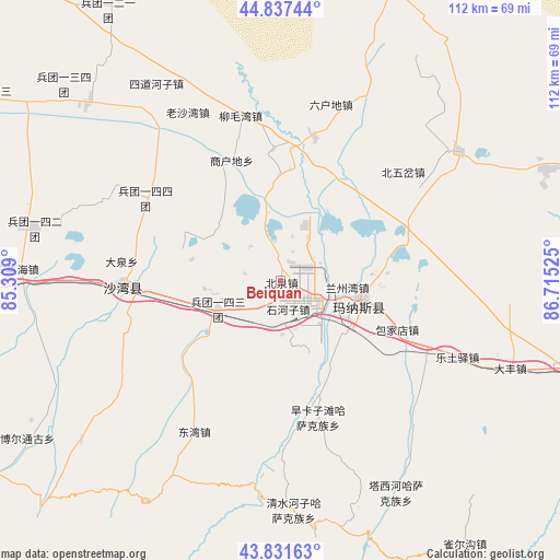
Beiquan GPS coordinates[2]
44° 20' 12.084" North, 86° 0' 43.632" East
| Map corner | latitude | longitude |
|---|---|---|
| Upper-left | 44.83744°, | 85.309° |
| Center: | 44.33669°, | 86.01212° |
| Lower-right: | 43.83163°, | 86.71525° |
| Map W x H: | 111.8×111.8 km | = 69.5×69.5mi |
| max Lat: | 53.31946° ⇑6.8% North |
| Beiquan: | 44.33669° |
| min Lat: | ⇓93.2% South 18.22056° |
| min Long | Beiquan | max Long |
| 75.07348° | 86.01212° | 134.28917° |
| W 1.6%⇐ | ⇒98.4% E |
Elevation
Elevation of Beiquan is 421 m = 1381 ft, and this is 63.8 m = 209 ft below average elevation for this country.
| Max E: |
5622 m = 18445 ft | 29.5% |
| Avg. | 484.8 m = 1591 ft | |
| Beiquan | 421 m = 1381 ft | |
Min E: |
-3 m = -10 ft | 70.5% |
See also: China elevation on elevation.city.
Geographical zone
Beiquan is located in North temperate zone (between Tropic of Cancer and the Arctic Circle). Distance of this Northern Tropic circle is 2323.9 km =1444 mi to South.| Distance of | km | miles | from Beiquan |
|---|---|---|---|
| North Pole | 5077.3 | 3154.9 | to North |
| Arctic Circle | 2471.4 | 1535.7 | to North |
| Tropic Cancer | 2323.9 | 1444 | to South |
| Equator | 4929.8 | 3063.2 | to South |


Nearby cities:
15 places around Beiquan: (largest is in red/bold)
• Baojiadian
25.4 km =15.8 mi,  112°
112°
• Beiwucha
32.6 km =20.3 mi,  48°
48°
• Daquan
34.4 km =21.4 mi,  274°
274°
• Dongwan
34.6 km =21.5 mi,  208°
208°
• Guangdongdi
18.4 km =11.4 mi,  85°
85°
• Hankazi
27.4 km =17 mi,  161°
161°
• Jingouhe
26.2 km =16.3 mi,  264°
264°
• Laoshawan
38.3 km =23.8 mi,  331°
331°
• Letuyi
38.6 km =24 mi, 113°
• Liumaowan
30.6 km =19 mi,  344°
344°
• Manasi
16.4 km =10.2 mi,  101°
101°
• Sandaohezi
31.2 km =19.4 mi, 267°
• Shanghudi
24.4 km =15.2 mi, 333°
• Shihezi
4.3 km =2.7 mi,  152°
152°
• Ulan Us
13.4 km =8.3 mi,  246°
246°
Sources, notices
• [Note1] Compared only with cities in China existing in our database
• [Src1] Map data: © OpenStreetMap contributors (CC-BY-SA)
• [Src2] Other city data from geonames.org with taken over terms of usage.
• [Src3] Geographical zone / Annual Mean Temperature by Robert A. Rohde @ Wikipedia
