Guquan geodata
Guquan (Anhui) is a seat of a fourth-order administrative division; located in China in Asia/Shanghai (GMT+8) time zone. In our database, there are 1268 cities with bigger population. Compared to other cities in China, 55.1% of cities are located further ↓South; 74.1% of cities are located further ←West and 77.2% of cities have higher elevation than Guquan. Note1


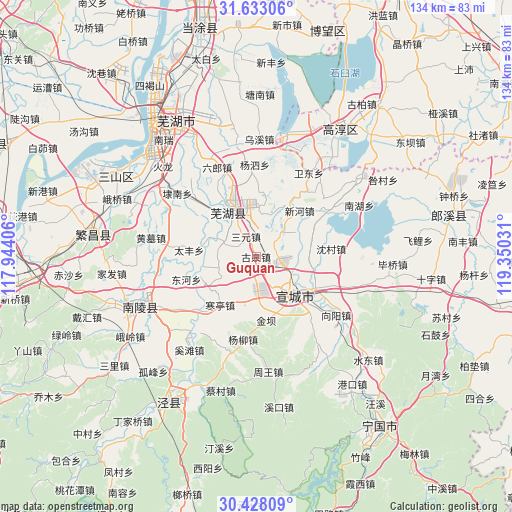
Guquan GPS coordinates[2]
31° 1' 56.928" North, 118° 38' 49.848" East
| Map corner | latitude | longitude |
|---|---|---|
| Upper-left | 31.63306°, | 117.94406° |
| Center: | 31.03248°, | 118.64718° |
| Lower-right: | 30.42809°, | 119.35031° |
| Map W x H: | 134×134 km | = 83.3×83.3mi |
| max Lat: | 53.31946° ⇑44.9% North |
| Guquan: | 31.03248° |
| min Lat: | ⇓55.1% South 18.22056° |
| min Long | Guquan | max Long |
| 75.07348° | 118.64718° | 134.28917° |
| W 74.1%⇐ | ⇒25.9% E |
Elevation
Elevation of Guquan is 32 m = 105 ft, and this is 452.8 m = 1486 ft below average elevation for this country.
| Max E: |
5622 m = 18445 ft | 77.2% |
| Avg. | 484.8 m = 1591 ft | |
| Guquan | 32 m = 105 ft | |
Min E: |
-3 m = -10 ft | 22.8% |
See also: China elevation on elevation.city.
Geographical zone
Guquan is located in North temperate zone (between Tropic of Cancer and the Arctic Circle). Distance of this Northern Tropic circle is 844.6 km =524.8 mi to South.| Distance of | km | miles | from Guquan |
|---|---|---|---|
| North Pole | 6556.6 | 4074.1 | to North |
| Arctic Circle | 3950.7 | 2454.9 | to North |
| Tropic Cancer | 844.6 | 524.8 | to South |
| Equator | 3450.5 | 2144 | to South |


Nearby cities:
15 places around Guquan: (largest is in red/bold)
• Hanting
15.8 km =9.8 mi,  216°
216°
• Huaqiao
17.7 km =11 mi,  14°
14°
• Jinba
17.2 km =10.7 mi,  172°
172°
• Rencunwan
12.5 km =7.8 mi,  58°
58°
• Sanyuan
5.9 km =3.7 mi,  333°
333°
• Shuangxi
17.1 km =10.6 mi,  118°
118°
• Taifeng
17.6 km =10.9 mi,  275°
275°
• Tianhu
13.7 km =8.5 mi,  200°
200°
• Wanzhi
14.8 km =9.2 mi, 329°
• Wuhu
14.9 km =9.3 mi, 328°
• Wuxing
13.1 km =8.1 mi,  101°
101°
• Xiadu
17.3 km =10.7 mi,  134°
134°
• Xihe
17.1 km =10.6 mi,  254°
254°
• Xinfeng
11.8 km =7.3 mi,  15°
15°
• Xuanzhou
13.6 km =8.5 mi, 130°
Sources, notices
• [Note1] Compared only with cities in China existing in our database
• [Src1] Map data: © OpenStreetMap contributors (CC-BY-SA)
• [Src2] Other city data from geonames.org with taken over terms of usage.
• [Src3] Geographical zone / Annual Mean Temperature by Robert A. Rohde @ Wikipedia
