Puerres geodata
Puerres (Nariño) is a populated place; located in Colombia in America/Bogota (GMT-5) time zone. With population of 3,812 people, there are 600 cities with bigger population in this country. Compared to other cities in Colombia, 96.3% of cities are located further ↑North; 94.4% of cities are located further →East and 91.7% of cities have lower elevation than Puerres. Note1


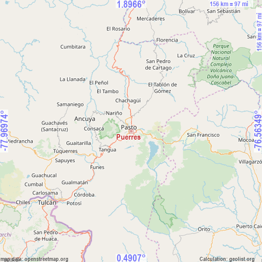
Puerres GPS coordinates[2]
1° 11' 37.464" North, 77° 15' 59.796" West
| Map corner | latitude | longitude |
|---|---|---|
| Upper-left | 1.8966°, | -77.96974° |
| Center: | 1.19374°, | -77.26661° |
| Lower-right: | 0.4907°, | -76.56349° |
| Map W x H: | 156.3×156.3 km | = 97.1×97.1mi |
| max Lat: | 13.38166° ⇑96.3% North |
| Puerres: | 1.19374° |
| min Lat: | ⇓3.7% South -4.21528° |
| min Long | Puerres | max Long |
| -81.70636° | -77.26661° | -67.06996° |
| W 5.6%⇐ | ⇒94.4% E |
Elevation
Elevation of Puerres is 2577 m = 8455 ft, and this is 1427.7 m = 4684 ft above average elevation for this country.
| Max E: |
3342 m = 10965 ft | 8.3% |
| Puerres | 2577 m 8455 ft | |
| Avg. | 1149.3 m = 3771 ft | |
Min E: |
1 m = 3 ft | 91.7% |
See also: Colombia elevation on elevation.city.
Geographical zone
Puerres is located in North Torrid zone (between Equator and Tropic of Cancer). Distance of Equator is 132.7 km =82.5 mi to South.| Distance of | km | miles | from Puerres |
|---|---|---|---|
| North Pole | 9874.3 | 6135.6 | to North |
| Arctic Circle | 7268.4 | 4516.4 | to North |
| Tropic Cancer | 2473.2 | 1536.8 | to North |
| Equator | 132.7 | 82.5 | to South |


Nearby cities:
15 places around Puerres: (largest is in red/bold)
• Ancuya
28.5 km =17.7 mi,  285°
285°
• Buesaco
24.4 km =15.2 mi,  30°
30°
• Chachagüí
18.5 km =11.5 mi,  354°
354°
• Consacá
22.2 km =13.8 mi,  274°
274°
• El Tambo
27.6 km =17.1 mi,  329°
329°
• Funes
29.5 km =18.3 mi,  223°
223°
• Imués
29.9 km =18.6 mi,  238°
238°
• La Florida
19.4 km =12.1 mi,  306°
306°
• Nariño
14.7 km =9.1 mi,  316°
316°
• Olaya Herrera
25.6 km =15.9 mi,  283°
283°
• Pasto
2.7 km =1.7 mi, 323°
• Sandoná
24.8 km =15.4 mi, 294°
• Santiago
29.6 km =18.4 mi,  99°
99°
• Tangua
18 km =11.2 mi,  232°
232°
• Yacuanquer
17.3 km =10.7 mi, 240°
Sources, notices
• [Note1] Compared only with cities in Colombia existing in our database
• [Src1] Map data: © OpenStreetMap contributors (CC-BY-SA)
• [Src2] Other city data from geonames.org with taken over terms of usage.
• [Src3] Geographical zone / Annual Mean Temperature by Robert A. Rohde @ Wikipedia
