Paispamba geodata
Paispamba (Cauca) is a seat of a second-order administrative division; located in Colombia in America/Bogota (GMT-5) time zone. With population of 1,390 people, there are 886 cities with bigger population in this country. Compared to other cities in Colombia, 88.7% of cities are located further ↑North; 88.3% of cities are located further →East and 89.4% of cities have lower elevation than Paispamba. Note1


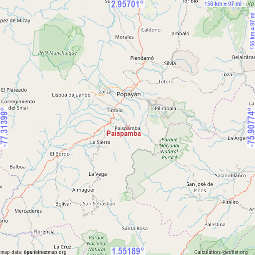
Paispamba GPS coordinates[2]
2° 15' 16.632" North, 76° 36' 39.096" West
| Map corner | latitude | longitude |
|---|---|---|
| Upper-left | 2.95701°, | -77.31399° |
| Center: | 2.25462°, | -76.61086° |
| Lower-right: | 1.55189°, | -75.90774° |
| Map W x H: | 156.2×156.2 km | = 97.1×97.1mi |
| max Lat: | 13.38166° ⇑88.7% North |
| Paispamba: | 2.25462° |
| min Lat: | ⇓11.3% South -4.21528° |
| min Long | Paispamba | max Long |
| -81.70636° | -76.61086° | -67.06996° |
| W 11.7%⇐ | ⇒88.3% E |
Elevation
Elevation of Paispamba is 2531 m = 8304 ft, and this is 1381.7 m = 4533 ft above average elevation for this country.
| Max E: |
3342 m = 10965 ft | 10.6% |
| Paispamba | 2531 m 8304 ft | |
| Avg. | 1149.3 m = 3771 ft | |
Min E: |
1 m = 3 ft | 89.4% |
See also: Colombia elevation on elevation.city.
Geographical zone
Paispamba is located in North Torrid zone (between Equator and Tropic of Cancer). Distance of Equator is 250.7 km =155.8 mi to South.| Distance of | km | miles | from Paispamba |
|---|---|---|---|
| North Pole | 9756.4 | 6062.3 | to North |
| Arctic Circle | 7150.5 | 4443.1 | to North |
| Tropic Cancer | 2355.2 | 1463.5 | to North |
| Equator | 250.7 | 155.8 | to South |


Nearby cities:
15 places around Paispamba: (largest is in red/bold)
• Almaguer
46.5 km =28.9 mi,  215°
215°
• Cajibío
41.2 km =25.6 mi,  6°
6°
• Coconuco
16.1 km =10 mi,  52°
52°
• El Bordo
44 km =27.3 mi,  249°
249°
• El Tambo
31.2 km =19.4 mi,  314°
314°
• La Sierra
18.9 km =11.7 mi,  243°
243°
• La Vega
33.7 km =20.9 mi,  213°
213°
• López
28.9 km =18 mi, 313°
• Piendamo
43.7 km =27.2 mi, 11°
• Popayán
20.4 km =12.7 mi,  359°
359°
• Rosas
14.3 km =8.9 mi,  272°
272°
• Sucre
42.4 km =26.3 mi, 235°
• Timbío
13.3 km =8.3 mi,  322°
322°
• Totoró
36.8 km =22.9 mi,  39°
39°
• Villa Rica
39.2 km =24.4 mi, 317°
Sources, notices
• [Note1] Compared only with cities in Colombia existing in our database
• [Src1] Map data: © OpenStreetMap contributors (CC-BY-SA)
• [Src2] Other city data from geonames.org with taken over terms of usage.
• [Src3] Geographical zone / Annual Mean Temperature by Robert A. Rohde @ Wikipedia
