La Merced geodata
La Merced (Risaralda) is a populated place; located in Colombia in America/Bogota (GMT-5) time zone. With population of 3,851 people, there are 599 cities with bigger population in this country. Compared to other cities in Colombia, 52.5% of cities are located further ↑North; 77.8% of cities are located further →East and 70.7% of cities have lower elevation than La Merced. Note1


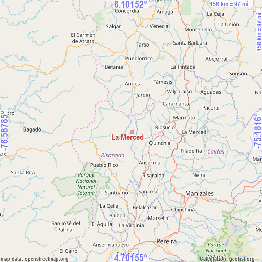
La Merced GPS coordinates[2]
5° 24' 6.984" North, 75° 53' 4.992" West
| Map corner | latitude | longitude |
|---|---|---|
| Upper-left | 6.10152°, | -76.58785° |
| Center: | 5.40194°, | -75.88472° |
| Lower-right: | 4.70155°, | -75.1816° |
| Map W x H: | 155.7×155.7 km | = 96.7×96.7mi |
| max Lat: | 13.38166° ⇑52.5% North |
| La Merced: | 5.40194° |
| min Lat: | ⇓47.5% South -4.21528° |
| min Long | La Merced | max Long |
| -81.70636° | -75.88472° | -67.06996° |
| W 22.2%⇐ | ⇒77.8% E |
Elevation
Elevation of La Merced is 1751 m = 5745 ft, and this is 601.7 m = 1974 ft above average elevation for this country.
| Max E: |
3342 m = 10965 ft | 29.3% |
| La Merced | 1751 m 5745 ft | |
| Avg. | 1149.3 m = 3771 ft | |
Min E: |
1 m = 3 ft | 70.7% |
See also: Colombia elevation on elevation.city.
Geographical zone
La Merced is located in North Torrid zone (between Equator and Tropic of Cancer). Distance of Equator is 600.6 km =373.2 mi to South.| Distance of | km | miles | from La Merced |
|---|---|---|---|
| North Pole | 9406.4 | 5844.9 | to North |
| Arctic Circle | 6800.5 | 4225.6 | to North |
| Tropic Cancer | 2005.3 | 1246 | to North |
| Equator | 600.6 | 373.2 | to South |


Nearby cities:
15 places around La Merced: (largest is in red/bold)
• Andes
28.3 km =17.6 mi,  1°
1°
• Anserma
12.9 km =8 mi,  126°
126°
• Anserma
21.6 km =13.4 mi,  149°
149°
• Apía
33.5 km =20.8 mi,  191°
191°
• Belén de Umbría
22.4 km =13.9 mi,  175°
175°
• Caramanta
31.2 km =19.4 mi,  58°
58°
• Guática
13.5 km =8.4 mi,  135°
135°
• Jardín
23.1 km =14.4 mi,  18°
18°
• Marmato
32.5 km =20.2 mi,  75°
75°
• Mistrató
11.8 km =7.3 mi, 179°
• Pueblo Rico
25.6 km =15.9 mi,  218°
218°
• Quinchía
18.5 km =11.5 mi,  112°
112°
• Riosucio
20.2 km =12.6 mi, 83°
• Risaralda
29.3 km =18.2 mi, 153°
• Supía
26.5 km =16.5 mi, 77°
Sources, notices
• [Note1] Compared only with cities in Colombia existing in our database
• [Src1] Map data: © OpenStreetMap contributors (CC-BY-SA)
• [Src2] Other city data from geonames.org with taken over terms of usage.
• [Src3] Geographical zone / Annual Mean Temperature by Robert A. Rohde @ Wikipedia
