Guachavés geodata
Guachavés (Nariño) is a seat of a second-order administrative division; located in Colombia in America/Bogota (GMT-5) time zone. In our database, there are 1053 cities with bigger population. Compared to other cities in Colombia, 95.8% of cities are located further ↑North; 98.2% of cities are located further →East and 88.4% of cities have lower elevation than Guachavés. Note1


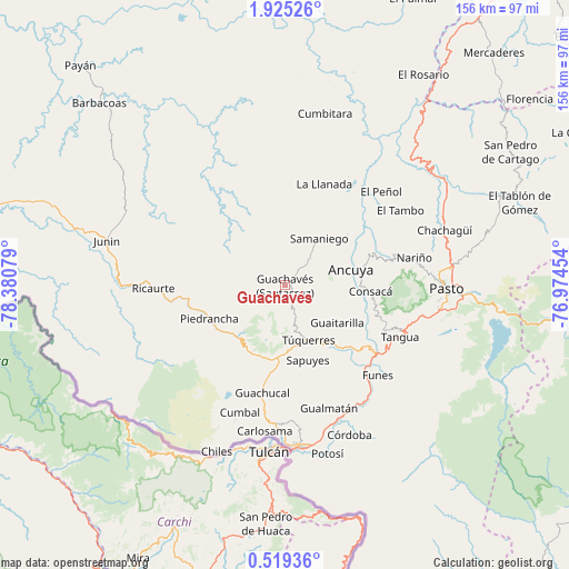
Guachavés GPS coordinates[2]
1° 13' 20.64" North, 77° 40' 39.576" West
| Map corner | latitude | longitude |
|---|---|---|
| Upper-left | 1.92526°, | -78.38079° |
| Center: | 1.2224°, | -77.67766° |
| Lower-right: | 0.51936°, | -76.97454° |
| Map W x H: | 156.3×156.3 km | = 97.1×97.1mi |
| max Lat: | 13.38166° ⇑95.8% North |
| Guachavés: | 1.2224° |
| min Lat: | ⇓4.2% South -4.21528° |
| min Long | Guachavés | max Long |
| -81.70636° | -77.67766° | -67.06996° |
| W 1.8%⇐ | ⇒98.2% E |
Elevation
Elevation of Guachavés is 2490 m = 8169 ft, and this is 1340.7 m = 4399 ft above average elevation for this country.
| Max E: |
3342 m = 10965 ft | 11.6% |
| Guachavés | 2490 m 8169 ft | |
| Avg. | 1149.3 m = 3771 ft | |
Min E: |
1 m = 3 ft | 88.4% |
See also: Colombia elevation on elevation.city.
Geographical zone
Guachavés is located in North Torrid zone (between Equator and Tropic of Cancer). Distance of Equator is 135.9 km =84.4 mi to South.| Distance of | km | miles | from Guachavés |
|---|---|---|---|
| North Pole | 9871.1 | 6133.6 | to North |
| Arctic Circle | 7265.3 | 4514.4 | to North |
| Tropic Cancer | 2470 | 1534.8 | to North |
| Equator | 135.9 | 84.4 | to South |


Nearby cities:
15 places around Guachavés: (largest is in red/bold)
• Ancuya
18.8 km =11.7 mi,  75°
75°
• Consacá
23.6 km =14.7 mi,  93°
93°
• Guachucal
29.7 km =18.5 mi,  191°
191°
• Guaitarilla
17.6 km =10.9 mi,  125°
125°
• Imués
27.4 km =17 mi, 132°
• La Llanada
29.9 km =18.6 mi,  21°
21°
• Linares
22.3 km =13.9 mi,  50°
50°
• Olaya Herrera
21 km =13 mi, 82°
• Ospina
22 km =13.7 mi,  145°
145°
• Piedrancha
22.7 km =14.1 mi,  246°
246°
• Providencia
9.1 km =5.7 mi, 78°
• Samaniego
15.8 km =9.8 mi,  35°
35°
• Sandoná
24.2 km =15 mi,  72°
72°
• Sapuyes
21.5 km =13.4 mi,  162°
162°
• Túquerres
16.5 km =10.3 mi, 156°
Sources, notices
• [Note1] Compared only with cities in Colombia existing in our database
• [Src1] Map data: © OpenStreetMap contributors (CC-BY-SA)
• [Src2] Other city data from geonames.org with taken over terms of usage.
• [Src3] Geographical zone / Annual Mean Temperature by Robert A. Rohde @ Wikipedia
