Guaca geodata
Guaca (Santander) is a seat of a second-order administrative division; located in Colombia in America/Bogota (GMT-5) time zone. With population of 1,637 people, there are 847 cities with bigger population in this country. Compared to other cities in Colombia, 73.1% of cities are located further ↓South; 89.5% of cities are located further ←West and 85.5% of cities have lower elevation than Guaca. Note1


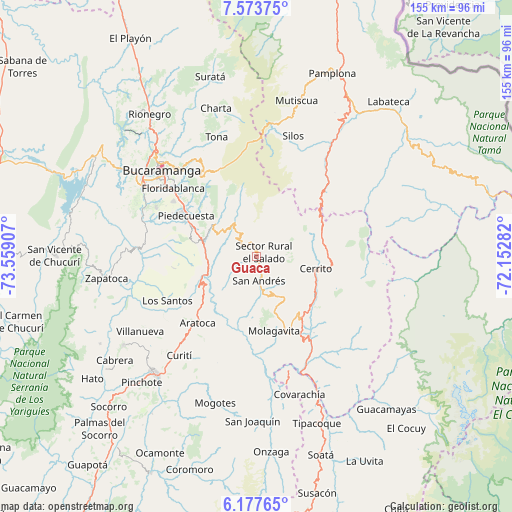
Guaca GPS coordinates[2]
6° 52' 34.356" North, 72° 51' 21.384" West
| Map corner | latitude | longitude |
|---|---|---|
| Upper-left | 7.57375°, | -73.55907° |
| Center: | 6.87621°, | -72.85594° |
| Lower-right: | 6.17765°, | -72.15282° |
| Map W x H: | 155.2×155.2 km | = 96.4×96.4mi |
| max Lat: | 13.38166° ⇑26.9% North |
| Guaca: | 6.87621° |
| min Lat: | ⇓73.1% South -4.21528° |
| min Long | Guaca | max Long |
| -81.70636° | -72.85594° | -67.06996° |
| W 89.5%⇐ | ⇒10.5% E |
Elevation
Elevation of Guaca is 2305 m = 7562 ft, and this is 1155.7 m = 3792 ft above average elevation for this country.
| Max E: |
3342 m = 10965 ft | 14.5% |
| Guaca | 2305 m 7562 ft | |
| Avg. | 1149.3 m = 3771 ft | |
Min E: |
1 m = 3 ft | 85.5% |
See also: Colombia elevation on elevation.city.
Geographical zone
Guaca is located in North Torrid zone (between Equator and Tropic of Cancer). Distance of Equator is 764.6 km =475.1 mi to South.| Distance of | km | miles | from Guaca |
|---|---|---|---|
| North Pole | 9242.5 | 5743 | to North |
| Arctic Circle | 6636.6 | 4123.8 | to North |
| Tropic Cancer | 1841.4 | 1144.2 | to North |
| Equator | 764.6 | 475.1 | to South |


Nearby cities:
15 places around Guaca: (largest is in red/bold)
• Aratoca
27.1 km =16.8 mi,  221°
221°
• Cepitá
18.8 km =11.7 mi, 223°
• Cerrito
18.2 km =11.3 mi,  101°
101°
• Chitagá
35.9 km =22.3 mi,  35°
35°
• Concepción
21.7 km =13.5 mi,  124°
124°
• Enciso
28.9 km =18 mi,  143°
143°
• Floridablanca
32.8 km =20.4 mi,  309°
309°
• Jordán
30.9 km =19.2 mi,  238°
238°
• Los Santos
30.7 km =19.1 mi, 243°
• Molagavita
23.2 km =14.4 mi,  167°
167°
• Málaga
24 km =14.9 mi,  145°
145°
• Piedecuesta
24.7 km =15.3 mi,  300°
300°
• San Andrés
7.2 km =4.5 mi, 174°
• San José de Miranda
27.7 km =17.2 mi, 150°
• Santa Bárbara
13.9 km =8.6 mi,  336°
336°
Sources, notices
• [Note1] Compared only with cities in Colombia existing in our database
• [Src1] Map data: © OpenStreetMap contributors (CC-BY-SA)
• [Src2] Other city data from geonames.org with taken over terms of usage.
• [Src3] Geographical zone / Annual Mean Temperature by Robert A. Rohde @ Wikipedia
