San Andrés geodata
San Andrés (Santander) is a seat of a second-order administrative division; located in Colombia in America/Bogota (GMT-5) time zone. With population of 3,032 people, there are 680 cities with bigger population in this country. Compared to other cities in Colombia, 72.5% of cities are located further ↓South; 89.6% of cities are located further ←West and 66.3% of cities have lower elevation than San Andrés. Note1


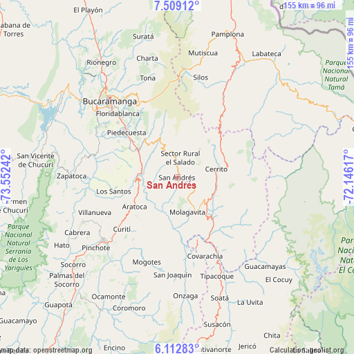
San Andrés GPS coordinates[2]
6° 48' 41.328" North, 72° 50' 57.444" West
| Map corner | latitude | longitude |
|---|---|---|
| Upper-left | 7.50912°, | -73.55242° |
| Center: | 6.81148°, | -72.84929° |
| Lower-right: | 6.11283°, | -72.14617° |
| Map W x H: | 155.3×155.3 km | = 96.5×96.5mi |
| max Lat: | 13.38166° ⇑27.5% North |
| San Andrés: | 6.81148° |
| min Lat: | ⇓72.5% South -4.21528° |
| min Long | San Andrés | max Long |
| -81.70636° | -72.84929° | -67.06996° |
| W 89.6%⇐ | ⇒10.4% E |
Elevation
Elevation of San Andrés is 1626 m = 5335 ft, and this is 476.7 m = 1564 ft above average elevation for this country.
| Max E: |
3342 m = 10965 ft | 33.7% |
| San Andrés | 1626 m 5335 ft | |
| Avg. | 1149.3 m = 3771 ft | |
Min E: |
1 m = 3 ft | 66.3% |
See also: Colombia elevation on elevation.city.
Geographical zone
San Andrés is located in North Torrid zone (between Equator and Tropic of Cancer). Distance of Equator is 757.4 km =470.6 mi to South.| Distance of | km | miles | from San Andrés |
|---|---|---|---|
| North Pole | 9249.7 | 5747.5 | to North |
| Arctic Circle | 6643.8 | 4128.3 | to North |
| Tropic Cancer | 1848.6 | 1148.7 | to North |
| Equator | 757.4 | 470.6 | to South |


Nearby cities:
15 places around San Andrés: (largest is in red/bold)
• Aratoca
22.8 km =14.2 mi,  235°
235°
• Carcasí
32 km =19.9 mi,  129°
129°
• Cepitá
15.2 km =9.4 mi,  245°
245°
• Cerrito
17.5 km =10.9 mi,  78°
78°
• Concepción
17.9 km =11.1 mi,  106°
106°
• El Peñón
29.1 km =18.1 mi,  176°
176°
• Enciso
22.9 km =14.2 mi, 134°
• Guaca
7.2 km =4.5 mi,  354°
354°
• Jordán
28.6 km =17.8 mi, 252°
• Los Santos
28.9 km =18 mi,  257°
257°
• Molagavita
16 km =9.9 mi,  163°
163°
• Málaga
18 km =11.2 mi, 134°
• Piedecuesta
29.6 km =18.4 mi,  311°
311°
• San José de Miranda
21.3 km =13.2 mi,  143°
143°
• Santa Bárbara
20.9 km =13 mi,  342°
342°
Sources, notices
• [Note1] Compared only with cities in Colombia existing in our database
• [Src1] Map data: © OpenStreetMap contributors (CC-BY-SA)
• [Src2] Other city data from geonames.org with taken over terms of usage.
• [Src3] Geographical zone / Annual Mean Temperature by Robert A. Rohde @ Wikipedia
