El Carmen geodata
El Carmen (Chocó) is a populated place; located in Colombia in America/Bogota (GMT-5) time zone. With population of 2,258 people, there are 768 cities with bigger population in this country. Compared to other cities in Colombia, 57.5% of cities are located further ↓South; 58.5% of cities are located further →East and 53.6% of cities have lower elevation than El Carmen. Note1


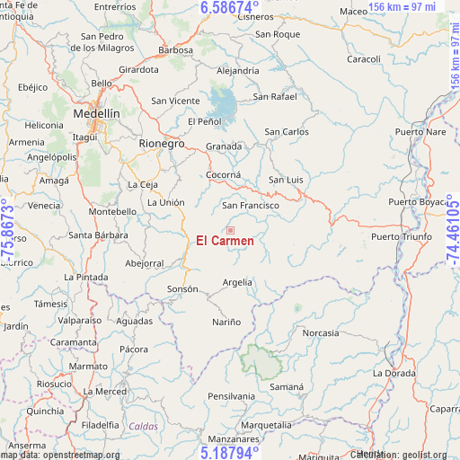
El Carmen GPS coordinates[2]
5° 53' 16.008" North, 75° 9' 51.012" West
| Map corner | latitude | longitude |
|---|---|---|
| Upper-left | 6.58674°, | -75.8673° |
| Center: | 5.88778°, | -75.16417° |
| Lower-right: | 5.18794°, | -74.46105° |
| Map W x H: | 155.5×155.5 km | = 96.6×96.6mi |
| max Lat: | 13.38166° ⇑42.5% North |
| El Carmen: | 5.88778° |
| min Lat: | ⇓57.5% South -4.21528° |
| min Long | El Carmen | max Long |
| -81.70636° | -75.16417° | -67.06996° |
| W 41.5%⇐ | ⇒58.5% E |
Elevation
Elevation of El Carmen is 1254 m = 4114 ft, and this is 104.7 m = 344 ft above average elevation for this country.
| Max E: |
3342 m = 10965 ft | 46.4% |
| El Carmen | 1254 m 4114 ft | |
| Avg. | 1149.3 m = 3771 ft | |
Min E: |
1 m = 3 ft | 53.6% |
See also: Colombia elevation on elevation.city.
Geographical zone
El Carmen is located in North Torrid zone (between Equator and Tropic of Cancer). Distance of Equator is 654.7 km =406.8 mi to South.| Distance of | km | miles | from El Carmen |
|---|---|---|---|
| North Pole | 9352.4 | 5811.3 | to North |
| Arctic Circle | 6746.5 | 4192.1 | to North |
| Tropic Cancer | 1951.3 | 1212.5 | to North |
| Equator | 654.7 | 406.8 | to South |


Nearby cities:
15 places around El Carmen: (largest is in red/bold)
• Abejorral
31.1 km =19.3 mi,  249°
249°
• Argelia
17.6 km =10.9 mi,  172°
172°
• Carmen de Viboral
28.7 km =17.8 mi,  318°
318°
• Cocorná
19 km =11.8 mi,  352°
352°
• Granada
28.5 km =17.7 mi,  355°
355°
• La Ceja
33.8 km =21 mi,  298°
298°
• La Unión
23.9 km =14.9 mi,  293°
293°
• Marinilla
37 km =23 mi,  329°
329°
• Nariño
31 km =19.3 mi,  182°
182°
• Rionegro
37.7 km =23.4 mi, 322°
• San Carlos
38.4 km =23.9 mi,  29°
29°
• San Francisco
11 km =6.8 mi,  39°
39°
• San Luis
25.6 km =15.9 mi,  47°
47°
• Santuario
30 km =18.6 mi,  338°
338°
• Sonsón
25.5 km =15.8 mi,  219°
219°
Sources, notices
• [Note1] Compared only with cities in Colombia existing in our database
• [Src1] Map data: © OpenStreetMap contributors (CC-BY-SA)
• [Src2] Other city data from geonames.org with taken over terms of usage.
• [Src3] Geographical zone / Annual Mean Temperature by Robert A. Rohde @ Wikipedia
