San Luis geodata
San Luis (Antioquia) is a seat of a second-order administrative division; located in Colombia in America/Bogota (GMT-5) time zone. In our database, there are 1053 cities with bigger population. Compared to other cities in Colombia, 60.1% of cities are located further ↓South; 54.1% of cities are located further →East and 51.8% of cities have higher elevation than San Luis. Note1


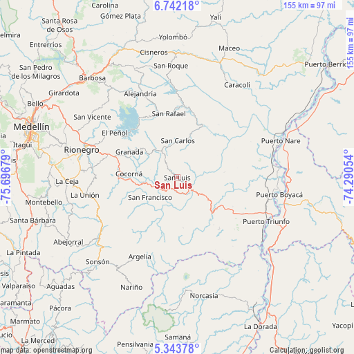
San Luis GPS coordinates[2]
6° 2' 36.348" North, 74° 59' 37.176" West
| Map corner | latitude | longitude |
|---|---|---|
| Upper-left | 6.74218°, | -75.69679° |
| Center: | 6.04343°, | -74.99366° |
| Lower-right: | 5.34378°, | -74.29054° |
| Map W x H: | 155.5×155.5 km | = 96.6×96.6mi |
| max Lat: | 13.38166° ⇑39.9% North |
| San Luis: | 6.04343° |
| min Lat: | ⇓60.1% South -4.21528° |
| min Long | San Luis | max Long |
| -81.70636° | -74.99366° | -67.06996° |
| W 45.9%⇐ | ⇒54.1% E |
Elevation
Elevation of San Luis is 1061 m = 3481 ft, and this is 88.3 m = 290 ft below average elevation for this country.
| Max E: |
3342 m = 10965 ft | 51.8% |
| Avg. | 1149.3 m = 3771 ft | |
| San Luis | 1061 m = 3481 ft | |
Min E: |
1 m = 3 ft | 48.2% |
See also: Colombia elevation on elevation.city.
Geographical zone
San Luis is located in North Torrid zone (between Equator and Tropic of Cancer). Distance of Equator is 672 km =417.6 mi to South.| Distance of | km | miles | from San Luis |
|---|---|---|---|
| North Pole | 9335.1 | 5800.6 | to North |
| Arctic Circle | 6729.2 | 4181.3 | to North |
| Tropic Cancer | 1934 | 1201.7 | to North |
| Equator | 672 | 417.6 | to South |


Nearby cities:
15 places around San Luis: (largest is in red/bold)
• Alejandría
40.5 km =25.2 mi,  336°
336°
• Argelia
38.4 km =23.9 mi,  205°
205°
• Carmen de Viboral
38 km =23.6 mi,  276°
276°
• Cocorná
21.2 km =13.2 mi,  274°
274°
• El Carmen
25.6 km =15.9 mi,  227°
227°
• Granada
23.9 km =14.9 mi,  297°
297°
• Guatapé
28.3 km =17.6 mi,  318°
318°
• La Unión
41.4 km =25.7 mi,  259°
259°
• Marinilla
40.5 km =25.2 mi,  290°
290°
• Puerto Triunfo
43.4 km =27 mi,  115°
115°
• Rionegro
43.8 km =27.2 mi, 286°
• San Carlos
16.1 km =10 mi,  0°
0°
• San Francisco
14.8 km =9.2 mi, 233°
• San Rafael
28.1 km =17.5 mi,  352°
352°
• Santuario
31.7 km =19.7 mi, 289°
Sources, notices
• [Note1] Compared only with cities in Colombia existing in our database
• [Src1] Map data: © OpenStreetMap contributors (CC-BY-SA)
• [Src2] Other city data from geonames.org with taken over terms of usage.
• [Src3] Geographical zone / Annual Mean Temperature by Robert A. Rohde @ Wikipedia
