Santa Genoveva de Docordó geodata
Santa Genoveva de Docordó (Chocó) is a seat of a second-order administrative division; located in Colombia in America/Bogota (GMT-5) time zone. With population of 1,448 people, there are 875 cities with bigger population in this country. Compared to other cities in Colombia, 75.5% of cities are located further ↑North; 95.2% of cities are located further →East and 98.5% of cities have higher elevation than Santa Genoveva de Docordó. Note1
Current local time in Santa Genoveva de Docordó:
05:47 AM, MondayDifference from your time zone: hours


Santa Genoveva de Docordó GPS coordinates[2]
4° 15' 31.5" North, 77° 21' 54.576" West
| Map corner | latitude | longitude |
|---|---|---|
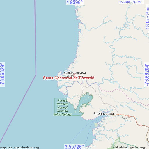
| Upper-left | 4.9596°, | -78.06829° |
| Center: | 4.25875°, | -77.36516° |
| Lower-right: | 3.55726°, | -76.66204° |
| Map W x H: | 155.9×155.9 km | = 96.9×96.9mi |
| max Lat: | 13.38166° ⇑75.5% North |
| Santa Genoveva de Docordó: | 4.25875° |
| min Lat: | ⇓24.5% South -4.21528° |
| min Long | Santa Genoveva | max Long |
| -81.70636° | -77.36516° | -67.06996° |
| W 4.8%⇐ | ⇒95.2% E |
Elevation
Elevation of Santa Genoveva de Docordó is 6 m = 20 ft, and this is 1143.3 m = 3751 ft below average elevation for this country.
| Max E: |
3342 m = 10965 ft | 98.5% |
| Avg. | 1149.3 m = 3771 ft | |
| Santa Genoveva de Docordó | 6 m = 20 ft | |
Min E: |
1 m = 3 ft | 1.5% |
See also: Colombia elevation on elevation.city.
Geographical zone
Santa Genoveva de Docordó is located in North Torrid zone (between Equator and Tropic of Cancer). Distance of Equator is 473.5 km =294.2 mi to South.| Distance of | km | miles | from Santa Genoveva de Docordó |
|---|---|---|---|
| North Pole | 9533.5 | 5923.8 | to North |
| Arctic Circle | 6927.6 | 4304.6 | to North |
| Tropic Cancer | 2132.4 | 1325 | to North |
| Equator | 473.5 | 294.2 | to South |


Nearby cities:
15 places around Santa Genoveva de Docordó: (largest is in red/bold)
• Buenaventura
56.1 km =34.9 mi,  138°
138°
• Buenaventura
85.3 km =53 mi,  151°
151°
• Calimita
103.2 km =64.1 mi,  111°
111°
• Dagua
100.6 km =62.5 mi,  131°
131°
• Darien
104.2 km =64.7 mi, 110°
• La Cumbre
111.2 km =69.1 mi, 127°
• Nóvita
114.4 km =71.1 mi,  47°
47°
• Pizarro
77.2 km =48 mi,  359°
359°
• Puerto Meluk
117.1 km =72.8 mi,  23°
23°
• Restrepo
105.3 km =65.4 mi,  117°
117°
• Riofrío
119.9 km =74.5 mi,  95°
95°
• Sipí
91.2 km =56.7 mi,  61°
61°
• Trujillo
116.1 km =72.1 mi,  92°
92°
• Vijes
119.8 km =74.4 mi, 121°
• Yotoco
117.5 km =73 mi, 112°
Sources, notices
• [Note1] Compared only with cities in Colombia existing in our database
• [Src1] Map data: © OpenStreetMap contributors (CC-BY-SA)
• [Src2] Other city data from geonames.org with taken over terms of usage.
• [Src3] Geographical zone / Annual Mean Temperature by Robert A. Rohde @ Wikipedia
