San Nicolás de Bari geodata
San Nicolás de Bari (Mayabeque) is a populated place; located in Cuba in America/Havana (GMT-4) time zone. With population of 14,914 people, there are 129 cities with bigger population in this country. Compared to other cities in Cuba, 73.5% of cities are located further ↓South; 71.8% of cities are located further →East and 64.6% of cities have higher elevation than San Nicolás de Bari. Note1


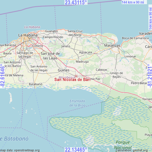
San Nicolás de Bari GPS coordinates[2]
22° 47' 3.984" North, 81° 54' 47.988" West
| Map corner | latitude | longitude |
|---|---|---|
| Upper-left | 23.43115°, | -82.61646° |
| Center: | 22.78444°, | -81.91333° |
| Lower-right: | 22.13465°, | -81.21021° |
| Map W x H: | 144.2×144.2 km | = 89.6×89.6mi |
| max Lat: | 23.15917° ⇑26.5% North |
| San Nicolás de Bari: | 22.78444° |
| min Lat: | ⇓73.5% South 19.90553° |
| min Long | San Nicolás de | max Long |
| -84.28599° | -81.91333° | -74.15181° |
| W 28.2%⇐ | ⇒71.8% E |
Elevation
Elevation of San Nicolás de Bari is 31 m = 102 ft, and this is 37.6 m = 123 ft below average elevation for this country.
| Max E: |
761 m = 2497 ft | 64.6% |
| Avg. | 68.6 m = 225 ft | |
| San Nicolás de Bari | 31 m = 102 ft | |
Min E: |
3 m = 10 ft | 35.4% |
See also: Cuba elevation on elevation.city.
Geographical zone
San Nicolás de Bari is located in North Torrid zone (between Equator and Tropic of Cancer). Distance of this Northern Tropic circle is 72.5 km =45 mi to North.| Distance of | km | miles | from San Nicolás de Bari |
|---|---|---|---|
| North Pole | 7473.7 | 4643.9 | to North |
| Arctic Circle | 4867.8 | 3024.7 | to North |
| Tropic Cancer | 72.5 | 45 | to North |
| Equator | 2533.4 | 1574.2 | to South |


Nearby cities:
15 places around San Nicolás de Bari: (largest is in red/bold)
• Alacranes
35.5 km =22.1 mi,  93°
93°
• Batabanó
39.3 km =24.4 mi,  259°
259°
• Guara
29.8 km =18.5 mi,  275°
275°
• Güines
13 km =8.1 mi,  296°
296°
• Jamaica
33.7 km =20.9 mi,  309°
309°
• Jaruco
30.5 km =19 mi,  341°
341°
• Madruga
15.1 km =9.4 mi,  22°
22°
• Matanzas
44.7 km =27.8 mi,  50°
50°
• Mañalich
24.2 km =15 mi, 277°
• Melena del Sur
24.4 km =15.2 mi,  270°
270°
• Nueva Paz
16.3 km =10.1 mi,  98°
98°
• Quivicán
45.5 km =28.3 mi, 275°
• San José de las Lajas
31.3 km =19.4 mi, 308°
• Santa Cruz del Norte
41.1 km =25.5 mi,  358°
358°
• Unión de Reyes
38.7 km =24 mi, 88°
Sources, notices
• [Note1] Compared only with cities in Cuba existing in our database
• [Src1] Map data: © OpenStreetMap contributors (CC-BY-SA)
• [Src2] Other city data from geonames.org with taken over terms of usage.
• [Src3] Geographical zone / Annual Mean Temperature by Robert A. Rohde @ Wikipedia
