Tsáda geodata
Tsáda (Pafos) is a populated place; located in Cyprus in Asia/Nicosia (GMT+2) time zone. With population of 1,043 people, there are 81 cities with bigger population in this country. Compared to other cities in Cyprus, 67.5% of cities are located further ↑North; 87.2% of cities are located further →East and 94.9% of cities have lower elevation than Tsáda. Note1


Tsáda GPS coordinates[2]
34° 50' 16.836" North, 32° 28' 31.692" East
| Map corner | latitude | longitude |
|---|---|---|
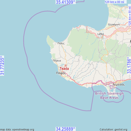
| Upper-left | 35.41309°, | 31.77235° |
| Center: | 34.83801°, | 32.47547° |
| Lower-right: | 34.25889°, | 33.1786° |
| Map W x H: | 128.3×128.3 km | = 79.7×79.7mi |
| max Lat: | 35.59719° ⇑67.5% North |
| Tsáda: | 34.83801° |
| min Lat: | ⇓32.5% South 34.66865° |
| min Long | Tsáda | max Long |
| 32.38166° | 32.47547° | 34.37916° |
| W 12.8%⇐ | ⇒87.2% E |
Elevation
Elevation of Tsáda is 615 m = 2018 ft, and this is 407 m = 1335 ft above average elevation for this country.
| Max E: |
1134 m = 3720 ft | 5.1% |
| Tsáda | 615 m 2018 ft | |
| Avg. | 208 m = 682 ft | |
Min E: |
4 m = 13 ft | 94.9% |
See also: Cyprus elevation on elevation.city.
Geographical zone
Tsáda is located in North temperate zone (between Tropic of Cancer and the Arctic Circle). Distance of this Northern Tropic circle is 1267.7 km =787.7 mi to South.| Distance of | km | miles | from Tsáda |
|---|---|---|---|
| North Pole | 6133.4 | 3811.1 | to North |
| Arctic Circle | 3527.6 | 2191.9 | to North |
| Tropic Cancer | 1267.7 | 787.7 | to South |
| Equator | 3873.6 | 2406.9 | to South |


Nearby cities:
15 places around Tsáda: (largest is in red/bold)
• Chlórakas
7.3 km =4.5 mi,  232°
232°
• Emba
5.8 km =3.6 mi, 233°
• Geroskipou
9.5 km =5.9 mi,  193°
193°
• Geroskípou (quarter)
8.7 km =5.4 mi, 194°
• Giólou
9.6 km =6 mi,  359°
359°
• Kissonerga
7 km =4.3 mi,  255°
255°
• Koloni
9.6 km =6 mi, 185°
• Konia
6.1 km =3.8 mi, 194°
• Lempa
7 km =4.3 mi,  242°
242°
• Mesógi
3.1 km =1.9 mi,  216°
216°
• Paphos
8.2 km =5.1 mi,  214°
214°
• Polémi
6.2 km =3.9 mi,  29°
29°
• Stroumpí
5 km =3.1 mi,  6°
6°
• Tsada - Tremithousa - Tala (Borders)
2 km =1.2 mi, 258°
• Tála
3.9 km =2.4 mi,  269°
269°
Sources, notices
• [Note1] Compared only with cities in Cyprus existing in our database
• [Src1] Map data: © OpenStreetMap contributors (CC-BY-SA)
• [Src2] Other city data from geonames.org with taken over terms of usage.
• [Src3] Geographical zone / Annual Mean Temperature by Robert A. Rohde @ Wikipedia
