Tsada - Tremithousa - Tala (Borders) geodata
Tsada - Tremithousa - Tala (Borders) (Pafos) is a seat of a third-order administrative division; located in Cyprus in Europe/Athens (GMT+2) time zone. In our database, there are 116 cities with bigger population. Compared to other cities in Cyprus, 69.2% of cities are located further ↑North; 91.5% of cities are located further →East and 93.2% of cities have lower elevation than Tsada - Tremithousa - Tala (Borders). Note1
Current local time in Tsada - Tremithousa - Tala (Borders):
09:24 AM, SundayDifference from your time zone: hours


Tsada - Tremithousa - Tala (Borders) GPS coordinates[2]
34° 50' 3.48" North, 32° 27' 13.068" East
| Map corner | latitude | longitude |
|---|---|---|
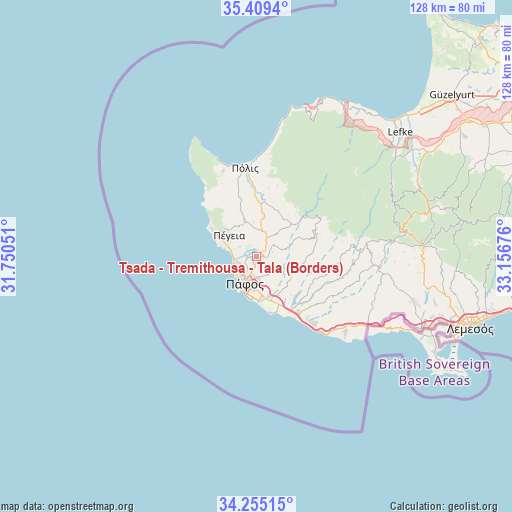
| Upper-left | 35.4094°, | 31.75051° |
| Center: | 34.8343°, | 32.45363° |
| Lower-right: | 34.25515°, | 33.15676° |
| Map W x H: | 128.3×128.3 km | = 79.7×79.7mi |
| max Lat: | 35.59719° ⇑69.2% North |
| Tsada - Tremithousa - Tala (Borders): | 34.8343° |
| min Lat: | ⇓30.8% South 34.66865° |
| min Long | Tsada - Tremith | max Long |
| 32.38166° | 32.45363° | 34.37916° |
| W 8.5%⇐ | ⇒91.5% E |
Elevation
Elevation of Tsada - Tremithousa - Tala (Borders) is 601 m = 1972 ft, and this is 393 m = 1289 ft above average elevation for this country.
| Max E: |
1134 m = 3720 ft | 6.8% |
| Tsada - Tremithousa - Tala (Borders) | 601 m 1972 ft | |
| Avg. | 208 m = 682 ft | |
Min E: |
4 m = 13 ft | 93.2% |
See also: Cyprus elevation on elevation.city.
Geographical zone
Tsada - Tremithousa - Tala (Borders) is located in North temperate zone (between Tropic of Cancer and the Arctic Circle). Distance of this Northern Tropic circle is 1267.3 km =787.5 mi to South.| Distance of | km | miles | from Tsada - Tremithousa - Tala (Borders) |
|---|---|---|---|
| North Pole | 6133.9 | 3811.4 | to North |
| Arctic Circle | 3528 | 2192.2 | to North |
| Tropic Cancer | 1267.3 | 787.5 | to South |
| Equator | 3873.2 | 2406.7 | to South |


Nearby cities:
15 places around Tsada - Tremithousa - Tala (Borders): (largest is in red/bold)
• Chlórakas
5.6 km =3.5 mi,  222°
222°
• Emba
4.1 km =2.5 mi, 221°
• Geroskipou
8.8 km =5.5 mi,  181°
181°
• Geroskípou (quarter)
8.1 km =5 mi, 181°
• Kissonerga
4.9 km =3 mi,  254°
254°
• Koloni
9.2 km =5.7 mi,  173°
173°
• Konia
5.5 km =3.4 mi, 174°
• Lempa
5.1 km =3.2 mi,  235°
235°
• Mesógi
2.1 km =1.3 mi, 175°
• Paphos
6.9 km =4.3 mi,  202°
202°
• Polémi
7.7 km =4.8 mi,  41°
41°
• Pégeia
8.5 km =5.3 mi,  309°
309°
• Stroumpí
6 km =3.7 mi,  25°
25°
• Tsáda
2 km =1.2 mi,  78°
78°
• Tála
1.9 km =1.2 mi,  280°
280°
Sources, notices
• [Note1] Compared only with cities in Cyprus existing in our database
• [Src1] Map data: © OpenStreetMap contributors (CC-BY-SA)
• [Src2] Other city data from geonames.org with taken over terms of usage.
• [Src3] Geographical zone / Annual Mean Temperature by Robert A. Rohde @ Wikipedia
