Geroskípou (quarter) geodata
Geroskípou (quarter) (Pafos) is a seat of a third-order administrative division; located in Cyprus in Asia/Nicosia (GMT+3) time zone. In our database, there are 116 cities with bigger population. Compared to other cities in Cyprus, 82.1% of cities are located further ↑North; 93.2% of cities are located further →East and 69.2% of cities have higher elevation than Geroskípou (quarter). Note1
Current local time in Geroskípou (quarter):
01:21 AM, WednesdayDifference from your time zone: hours


Geroskípou (quarter) GPS coordinates[2]
34° 45' 42.84" North, 32° 27' 4.86" East
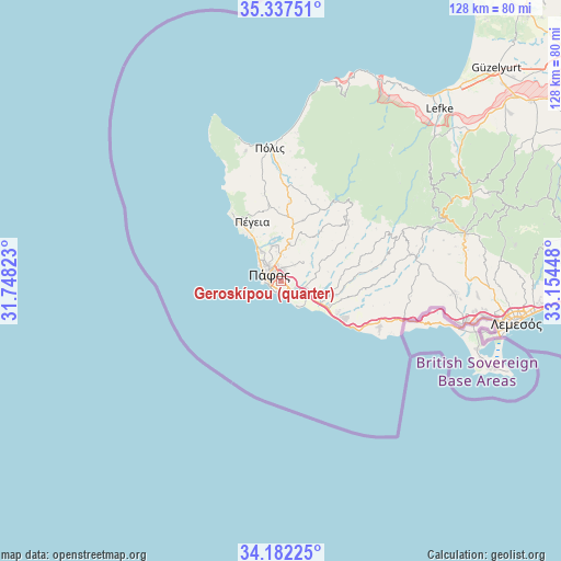
| Map corner | latitude | longitude |
|---|---|---|
| Upper-left | 35.33751°, | 31.74823° |
| Center: | 34.7619°, | 32.45135° |
| Lower-right: | 34.18225°, | 33.15448° |
| Map W x H: | 128.5×128.5 km | = 79.8×79.8mi |
| max Lat: | 35.59719° ⇑82.1% North |
| Geroskípou (quarter): | 34.7619° |
| min Lat: | ⇓17.9% South 34.66865° |
| min Long | Geroskípou (qu | max Long |
| 32.38166° | 32.45135° | 34.37916° |
| W 6.8%⇐ | ⇒93.2% E |
Elevation
Elevation of Geroskípou (quarter) is 69 m = 226 ft, and this is 139 m = 456 ft below average elevation for this country.
| Max E: |
1134 m = 3720 ft | 69.2% |
| Avg. | 208 m = 682 ft | |
| Geroskípou (quarter) | 69 m = 226 ft | |
Min E: |
4 m = 13 ft | 30.8% |
See also: Cyprus elevation on elevation.city.
Geographical zone
Geroskípou (quarter) is located in North temperate zone (between Tropic of Cancer and the Arctic Circle). Distance of this Northern Tropic circle is 1259.2 km =782.4 mi to South.| Distance of | km | miles | from Geroskípou (quarter) |
|---|---|---|---|
| North Pole | 6141.9 | 3816.4 | to North |
| Arctic Circle | 3536 | 2197.2 | to North |
| Tropic Cancer | 1259.2 | 782.4 | to South |
| Equator | 3865.2 | 2401.7 | to South |


Nearby cities:
15 places around Geroskípou (quarter): (largest is in red/bold)
• Anaríta
7.9 km =4.9 mi,  107°
107°
• Chlórakas
5.4 km =3.4 mi,  317°
317°
• Emba
5.6 km =3.5 mi,  333°
333°
• Geroskipou
0.8 km =0.5 mi,  178°
178°
• Kissonerga
8.2 km =5.1 mi, 325°
• Koloni
1.6 km =1 mi,  130°
130°
• Konia
2.7 km =1.7 mi,  15°
15°
• Kouklia
12.6 km =7.8 mi,  117°
117°
• Lempa
6.5 km =4 mi, 322°
• Mesógi
6 km =3.7 mi,  3°
3°
• Paphos
3 km =1.9 mi,  304°
304°
• Tsada - Tremithousa - Tala (Borders)
8.1 km =5 mi, 1°
• Tsáda
8.7 km =5.4 mi,  14°
14°
• Tála
8.6 km =5.3 mi,  348°
348°
• Tími
6.8 km =4.2 mi, 118°
Sources, notices
• [Note1] Compared only with cities in Cyprus existing in our database
• [Src1] Map data: © OpenStreetMap contributors (CC-BY-SA)
• [Src2] Other city data from geonames.org with taken over terms of usage.
• [Src3] Geographical zone / Annual Mean Temperature by Robert A. Rohde @ Wikipedia
