Peléndri geodata
Peléndri (Limassol) is a populated place; located in Cyprus in Asia/Nicosia (GMT+2) time zone. With population of 1,237 people, there are 70 cities with bigger population in this country. Compared to other cities in Cyprus, 59% of cities are located further ↑North; 67.5% of cities are located further →East and 98.3% of cities have lower elevation than Peléndri. Note1


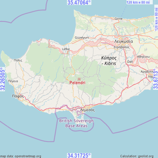
Peléndri GPS coordinates[2]
34° 53' 45.492" North, 32° 58' 5.412" East
| Map corner | latitude | longitude |
|---|---|---|
| Upper-left | 35.47064°, | 32.26505° |
| Center: | 34.89597°, | 32.96817° |
| Lower-right: | 34.31725°, | 33.6713° |
| Map W x H: | 128.2×128.2 km | = 79.7×79.7mi |
| max Lat: | 35.59719° ⇑59% North |
| Peléndri: | 34.89597° |
| min Lat: | ⇓41% South 34.66865° |
| min Long | Peléndri | max Long |
| 32.38166° | 32.96817° | 34.37916° |
| W 32.5%⇐ | ⇒67.5% E |
Elevation
Elevation of Peléndri is 898 m = 2946 ft, and this is 690 m = 2264 ft above average elevation for this country.
| Max E: |
1134 m = 3720 ft | 1.7% |
| Peléndri | 898 m 2946 ft | |
| Avg. | 208 m = 682 ft | |
Min E: |
4 m = 13 ft | 98.3% |
See also: Cyprus elevation on elevation.city.
Geographical zone
Peléndri is located in North temperate zone (between Tropic of Cancer and the Arctic Circle). Distance of this Northern Tropic circle is 1274.1 km =791.7 mi to South.| Distance of | km | miles | from Peléndri |
|---|---|---|---|
| North Pole | 6127 | 3807.1 | to North |
| Arctic Circle | 3521.1 | 2187.9 | to North |
| Tropic Cancer | 1274.1 | 791.7 | to South |
| Equator | 3880.1 | 2411 | to South |


Nearby cities:
15 places around Peléndri: (largest is in red/bold)
• Agrós
5.2 km =3.2 mi,  61°
61°
• Evrýchou
17.2 km =10.7 mi,  339°
339°
• Galáta
12.9 km =8 mi,  330°
330°
• Kakopetriá
11.7 km =7.3 mi, 330°
• Klírou
23.6 km =14.7 mi,  54°
54°
• Korákou
17.7 km =11 mi, 335°
• Kyperoúnta
4.7 km =2.9 mi,  8°
8°
• Mitseró
21.6 km =13.4 mi,  41°
41°
• Mouttagiáka
23 km =14.3 mi,  148°
148°
• Palodeia
17.1 km =10.6 mi,  168°
168°
• Páchna
20.6 km =12.8 mi,  230°
230°
• Páno Kivídes
18.4 km =11.4 mi,  213°
213°
• Páno Polemídia
21.3 km =13.2 mi, 173°
• Sotíra
22.6 km =14 mi, 205°
• Ýpsonas
23.1 km =14.4 mi,  181°
181°
Sources, notices
• [Note1] Compared only with cities in Cyprus existing in our database
• [Src1] Map data: © OpenStreetMap contributors (CC-BY-SA)
• [Src2] Other city data from geonames.org with taken over terms of usage.
• [Src3] Geographical zone / Annual Mean Temperature by Robert A. Rohde @ Wikipedia
