Lápithos geodata
Lápithos (Keryneia) is a populated place; located in Cyprus in Asia/Famagusta (GMT+2) time zone. With population of 5,215 people, there are 20 cities with bigger population in this country. Compared to other cities in Cyprus, 98.3% of cities are located further ↓South; 53% of cities are located further →East and 60.7% of cities have higher elevation than Lápithos. Note1


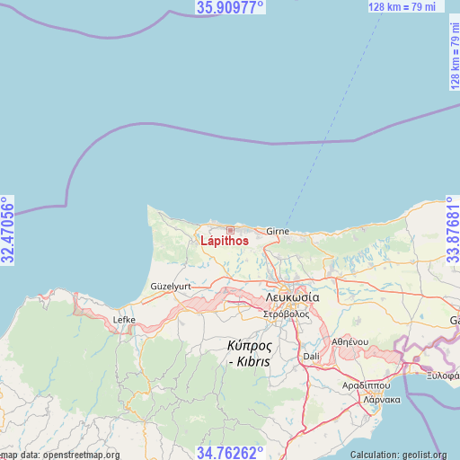
Lápithos GPS coordinates[2]
35° 20' 17.628" North, 33° 10' 25.248" East
| Map corner | latitude | longitude |
|---|---|---|
| Upper-left | 35.90977°, | 32.47056° |
| Center: | 35.33823°, | 33.17368° |
| Lower-right: | 34.76262°, | 33.87681° |
| Map W x H: | 127.6×127.6 km | = 79.3×79.3mi |
| max Lat: | 35.59719° ⇑1.7% North |
| Lápithos: | 35.33823° |
| min Lat: | ⇓98.3% South 34.66865° |
| min Long | Lápithos | max Long |
| 32.38166° | 33.17368° | 34.37916° |
| W 47%⇐ | ⇒53% E |
Elevation
Elevation of Lápithos is 85 m = 279 ft, and this is 123 m = 404 ft below average elevation for this country.
| Max E: |
1134 m = 3720 ft | 60.7% |
| Avg. | 208 m = 682 ft | |
| Lápithos | 85 m = 279 ft | |
Min E: |
4 m = 13 ft | 39.3% |
See also: Cyprus elevation on elevation.city.
Geographical zone
Lápithos is located in North temperate zone (between Tropic of Cancer and the Arctic Circle). Distance of this Northern Tropic circle is 1323.3 km =822.3 mi to South.| Distance of | km | miles | from Lápithos |
|---|---|---|---|
| North Pole | 6077.8 | 3776.6 | to North |
| Arctic Circle | 3471.9 | 2157.3 | to North |
| Tropic Cancer | 1323.3 | 822.3 | to South |
| Equator | 3929.2 | 2441.5 | to South |


Nearby cities:
15 places around Lápithos: (largest is in red/bold)
• Akáki
23.1 km =14.4 mi,  190°
190°
• Astromerítis
25.2 km =15.7 mi,  209°
209°
• Ergátes
32.3 km =20.1 mi,  168°
168°
• Kokkinotrimithiá
20.7 km =12.9 mi, 173°
• Kyrenia
13 km =8.1 mi,  90°
90°
• Káto Defterá
29.7 km =18.5 mi,  161°
161°
• Mámmari
18.2 km =11.3 mi, 171°
• Méniko
25.6 km =15.9 mi, 185°
• Mórfou
22.6 km =14 mi,  226°
226°
• Nicosia
25 km =15.5 mi,  136°
136°
• Oroúnta
27.3 km =17 mi,  195°
195°
• Peristeróna
24.8 km =15.4 mi, 200°
• Potámi
29.1 km =18.1 mi, 206°
• Psimolofou
31.7 km =19.7 mi, 165°
• Páno Defterá
30.1 km =18.7 mi, 163°
Sources, notices
• [Note1] Compared only with cities in Cyprus existing in our database
• [Src1] Map data: © OpenStreetMap contributors (CC-BY-SA)
• [Src2] Other city data from geonames.org with taken over terms of usage.
• [Src3] Geographical zone / Annual Mean Temperature by Robert A. Rohde @ Wikipedia
