Zwenkau geodata
Zwenkau (Saxony) is a populated place; located in Germany in Europe/Berlin (GMT+2) time zone. With population of 8,905 people, there are 1808 cities with bigger population in this country. Compared to other cities in Germany, 61.8% of cities are located further ↓South; 86.1% of cities are located further ←West and 62.2% of cities have higher elevation than Zwenkau. Note1


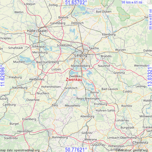
Zwenkau GPS coordinates[2]
51° 13' 7.392" North, 12° 19' 48.288" East
| Map corner | latitude | longitude |
|---|---|---|
| Upper-left | 51.65702°, | 11.62696° |
| Center: | 51.21872°, | 12.33008° |
| Lower-right: | 50.77621°, | 13.03321° |
| Map W x H: | 97.9×97.9 km | = 60.8×60.8mi |
| max Lat: | 55.01917° ⇑38.2% North |
| Zwenkau: | 51.21872° |
| min Lat: | ⇓61.8% South 47.40724° |
| min Long | Zwenkau | max Long |
| 5.92978° | 12.33008° | 14.98853° |
| W 86.1%⇐ | ⇒13.9% E |
Elevation
Elevation of Zwenkau is 137 m = 449 ft, and this is 112.1 m = 368 ft below average elevation for this country.
| Max E: |
1256 m = 4121 ft | 62.2% |
| Avg. | 249.1 m = 817 ft | |
| Zwenkau | 137 m = 449 ft | |
Min E: |
-5 m = -16 ft | 37.8% |
See also: Germany elevation on elevation.city.
Geographical zone
Zwenkau is located in North temperate zone (between Tropic of Cancer and the Arctic Circle). Distance of this North polar circle is 1706.2 km =1060.2 mi to North.| Distance of | km | miles | from Zwenkau |
|---|---|---|---|
| North Pole | 4312.1 | 2679.4 | to North |
| Arctic Circle | 1706.2 | 1060.2 | to North |
| Tropic Cancer | 3089.1 | 1919.5 | to South |
| Equator | 5695 | 3538.7 | to South |


Nearby cities:
15 places around Zwenkau: (largest is in red/bold)
• Böhlen
4.4 km =2.7 mi,  117°
117°
• Elstertrebnitz
10.2 km =6.3 mi,  221°
221°
• Espenhain
10.9 km =6.8 mi,  107°
107°
• Groitzsch
7.8 km =4.8 mi,  205°
205°
• Großgörschen
10.2 km =6.3 mi,  268°
268°
• Großpösna
13 km =8.1 mi,  65°
65°
• Kitzen
7.4 km =4.6 mi, 272°
• Lobstädt
12.6 km =7.8 mi,  138°
138°
• Lucka
13.5 km =8.4 mi,  179°
179°
• Markkleeberg
6.9 km =4.3 mi,  23°
23°
• Markranstädt
12 km =7.5 mi,  320°
320°
• Neukieritzsch
9.5 km =5.9 mi, 143°
• Pegau
7.9 km =4.9 mi, 223°
• Rötha
6.3 km =3.9 mi, 111°
• Starsiedel
13.3 km =8.3 mi, 269°
Sources, notices
• [Note1] Compared only with cities in Germany existing in our database
• [Src1] Map data: © OpenStreetMap contributors (CC-BY-SA)
• [Src2] Other city data from geonames.org with taken over terms of usage.
• [Src3] Geographical zone / Annual Mean Temperature by Robert A. Rohde @ Wikipedia
