Zichow geodata
Zichow (Brandenburg) is a seat of a fourth-order administrative division; located in Germany in Europe/Berlin (GMT+2) time zone. With population of 631 people, there are 8646 cities with bigger population in this country. Compared to other cities in Germany, 82.8% of cities are located further ↓South; 98.1% of cities are located further ←West and 75% of cities have higher elevation than Zichow. Note1


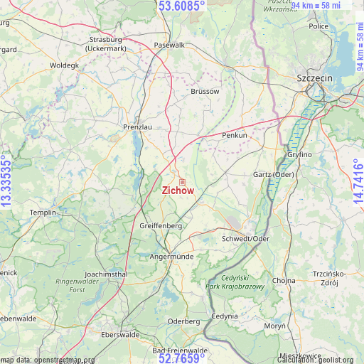
Zichow GPS coordinates[2]
53° 11' 21.372" North, 14° 2' 18.492" East
| Map corner | latitude | longitude |
|---|---|---|
| Upper-left | 53.6085°, | 13.33535° |
| Center: | 53.18927°, | 14.03847° |
| Lower-right: | 52.7659°, | 14.7416° |
| Map W x H: | 93.7×93.7 km | = 58.2×58.2mi |
| max Lat: | 55.01917° ⇑17.2% North |
| Zichow: | 53.18927° |
| min Lat: | ⇓82.8% South 47.40724° |
| min Long | Zichow | max Long |
| 5.92978° | 14.03847° | 14.98853° |
| W 98.1%⇐ | ⇒1.9% E |
Elevation
Elevation of Zichow is 63 m = 207 ft, and this is 186.1 m = 611 ft below average elevation for this country.
| Max E: |
1256 m = 4121 ft | 75% |
| Avg. | 249.1 m = 817 ft | |
| Zichow | 63 m = 207 ft | |
Min E: |
-5 m = -16 ft | 25% |
See also: Germany elevation on elevation.city.
Geographical zone
Zichow is located in North temperate zone (between Tropic of Cancer and the Arctic Circle). Distance of this North polar circle is 1487.1 km =924 mi to North.| Distance of | km | miles | from Zichow |
|---|---|---|---|
| North Pole | 4093 | 2543.3 | to North |
| Arctic Circle | 1487.1 | 924 | to North |
| Tropic Cancer | 3308.2 | 2055.6 | to South |
| Equator | 5914.1 | 3674.9 | to South |


Nearby cities:
15 places around Zichow: (largest is in red/bold)
• Angermünde
19.6 km =12.2 mi,  187°
187°
• Casekow
11.6 km =7.2 mi,  77°
77°
• Gerswalde
19.4 km =12.1 mi,  263°
263°
• Gramzow
3.3 km =2.1 mi,  321°
321°
• Grünow
15.3 km =9.5 mi,  337°
337°
• Krackow
22.9 km =14.2 mi,  41°
41°
• Meyenburg
20.8 km =12.9 mi,  140°
140°
• Passow
7.2 km =4.5 mi, 135°
• Penkun
17.8 km =11.1 mi,  47°
47°
• Pinnow
14.5 km =9 mi,  167°
167°
• Prenzlau
18.3 km =11.4 mi, 320°
• Schenkenberg
20.6 km =12.8 mi, 343°
• Schwedt (Oder)
21.7 km =13.5 mi,  131°
131°
• Schöneberg
21.3 km =13.2 mi,  160°
160°
• Tantow
22.7 km =14.1 mi,  66°
66°
Sources, notices
• [Note1] Compared only with cities in Germany existing in our database
• [Src1] Map data: © OpenStreetMap contributors (CC-BY-SA)
• [Src2] Other city data from geonames.org with taken over terms of usage.
• [Src3] Geographical zone / Annual Mean Temperature by Robert A. Rohde @ Wikipedia
