Würzweiler geodata
Würzweiler (Rheinland-Pfalz) is a seat of a fourth-order administrative division; located in Germany in Europe/Berlin (GMT+2) time zone. With population of 202 people, there are 10463 cities with bigger population in this country. Compared to other cities in Germany, 72.6% of cities are located further ↑North; 79.7% of cities are located further →East and 67.5% of cities have lower elevation than Würzweiler. Note1


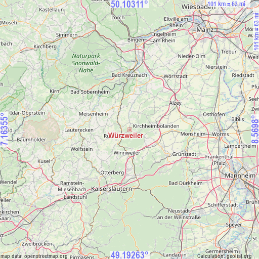
Würzweiler GPS coordinates[2]
49° 39' 0" North, 7° 52' 0.012" East
| Map corner | latitude | longitude |
|---|---|---|
| Upper-left | 50.10311°, | 7.16355° |
| Center: | 49.65°, | 7.86667° |
| Lower-right: | 49.19263°, | 8.5698° |
| Map W x H: | 101.2×101.2 km | = 62.9×62.9mi |
| max Lat: | 55.01917° ⇑72.6% North |
| Würzweiler: | 49.65° |
| min Lat: | ⇓27.4% South 47.40724° |
| min Long | Würzweiler | max Long |
| 5.92978° | 7.86667° | 14.98853° |
| W 20.3%⇐ | ⇒79.7% E |
Elevation
Elevation of Würzweiler is 339 m = 1112 ft, and this is 89.9 m = 295 ft above average elevation for this country.
| Max E: |
1256 m = 4121 ft | 32.5% |
| Würzweiler | 339 m 1112 ft | |
| Avg. | 249.1 m = 817 ft | |
Min E: |
-5 m = -16 ft | 67.5% |
See also: Germany elevation on elevation.city.
Geographical zone
Würzweiler is located in North temperate zone (between Tropic of Cancer and the Arctic Circle). Distance of this North polar circle is 1880.6 km =1168.6 mi to North.| Distance of | km | miles | from Würzweiler |
|---|---|---|---|
| North Pole | 4486.5 | 2787.8 | to North |
| Arctic Circle | 1880.6 | 1168.6 | to North |
| Tropic Cancer | 2914.6 | 1811 | to South |
| Equator | 5520.6 | 3430.3 | to South |


Nearby cities:
15 places around Würzweiler: (largest is in red/bold)
• Bayerfeld-Steckweiler
6.1 km =3.8 mi,  307°
307°
• Dannenfels
6 km =3.7 mi,  113°
113°
• Dielkirchen
4 km =2.5 mi,  297°
297°
• Falkenstein
5.7 km =3.5 mi,  167°
167°
• Gaugrehweiler
5.6 km =3.5 mi,  0°
0°
• Gerbach
1.9 km =1.2 mi, 0°
• Imsweiler
7.3 km =4.5 mi,  220°
220°
• Jakobsweiler
7.1 km =4.4 mi,  121°
121°
• Katzenbach
4.2 km =2.6 mi,  262°
262°
• Mannweiler-Cölln
7.1 km =4.4 mi, 301°
• Oberhausen an der Appel
7.4 km =4.6 mi, 0°
• Rockenhausen
4 km =2.5 mi,  235°
235°
• Ruppertsecken
1.2 km =0.7 mi,  90°
90°
• Sankt Alban
3.7 km =2.3 mi, 0°
• Stahlberg
6.3 km =3.9 mi,  287°
287°
Sources, notices
• [Note1] Compared only with cities in Germany existing in our database
• [Src1] Map data: © OpenStreetMap contributors (CC-BY-SA)
• [Src2] Other city data from geonames.org with taken over terms of usage.
• [Src3] Geographical zone / Annual Mean Temperature by Robert A. Rohde @ Wikipedia
