Rockenhausen geodata
Rockenhausen (Rheinland-Pfalz) is a populated place; located in Germany in Europe/Berlin (GMT+2) time zone. With population of 5,744 people, there are 2546 cities with bigger population in this country. Compared to other cities in Germany, 73.1% of cities are located further ↑North; 80.5% of cities are located further →East and 53% of cities have higher elevation than Rockenhausen. Note1
Administrative division(s):
- Level 1: Rheinland-Pfalz
- Level 3: Donnersbergkreis
- Level 4: Rockenhausen


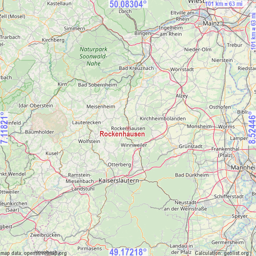
Rockenhausen GPS coordinates[2]
49° 37' 47.064" North, 7° 49' 16.824" East
| Map corner | latitude | longitude |
|---|---|---|
| Upper-left | 50.08304°, | 7.11821° |
| Center: | 49.62974°, | 7.82134° |
| Lower-right: | 49.17218°, | 8.52446° |
| Map W x H: | 101.3×101.3 km | = 62.9×62.9mi |
| max Lat: | 55.01917° ⇑73.1% North |
| Rockenhausen: | 49.62974° |
| min Lat: | ⇓26.9% South 47.40724° |
| min Long | Rockenhausen | max Long |
| 5.92978° | 7.82134° | 14.98853° |
| W 19.5%⇐ | ⇒80.5% E |
Elevation
Elevation of Rockenhausen is 204 m = 669 ft, and this is 45.1 m = 148 ft below average elevation for this country.
| Max E: |
1256 m = 4121 ft | 53% |
| Avg. | 249.1 m = 817 ft | |
| Rockenhausen | 204 m = 669 ft | |
Min E: |
-5 m = -16 ft | 47% |
See also: Germany elevation on elevation.city.
Geographical zone
Rockenhausen is located in North temperate zone (between Tropic of Cancer and the Arctic Circle). Distance of this North polar circle is 1882.9 km =1170 mi to North.| Distance of | km | miles | from Rockenhausen |
|---|---|---|---|
| North Pole | 4488.8 | 2789.2 | to North |
| Arctic Circle | 1882.9 | 1170 | to North |
| Tropic Cancer | 2912.4 | 1809.7 | to South |
| Equator | 5518.3 | 3428.9 | to South |


Nearby cities:
15 places around Rockenhausen: (largest is in red/bold)
• Bayerfeld-Steckweiler
6.2 km =3.9 mi,  345°
345°
• Bisterschied
5.6 km =3.5 mi,  293°
293°
• Dielkirchen
4.1 km =2.5 mi,  355°
355°
• Dörrmoschel
5.3 km =3.3 mi,  254°
254°
• Falkenstein
5.6 km =3.5 mi,  126°
126°
• Gerbach
5.2 km =3.2 mi,  38°
38°
• Gundersweiler
4.3 km =2.7 mi,  219°
219°
• Imsweiler
3.6 km =2.2 mi,  204°
204°
• Katzenbach
1.9 km =1.2 mi,  332°
332°
• Ransweiler
5.7 km =3.5 mi,  316°
316°
• Ruppertsecken
5 km =3.1 mi,  63°
63°
• Schweisweiler
5.2 km =3.2 mi,  183°
183°
• Schönborn
4 km =2.5 mi,  275°
275°
• Stahlberg
4.9 km =3 mi, 326°
• Würzweiler
4 km =2.5 mi, 55°
Sources, notices
• [Note1] Compared only with cities in Germany existing in our database
• [Src1] Map data: © OpenStreetMap contributors (CC-BY-SA)
• [Src2] Other city data from geonames.org with taken over terms of usage.
• [Src3] Geographical zone / Annual Mean Temperature by Robert A. Rohde @ Wikipedia
