Wurmannsquick geodata
Wurmannsquick (Bavaria) is a populated place; located in Germany in Europe/Berlin (GMT+2) time zone. With population of 3,710 people, there are 3468 cities with bigger population in this country. Compared to other cities in Germany, 90.7% of cities are located further ↑North; 90.6% of cities are located further ←West and 88.3% of cities have lower elevation than Wurmannsquick. Note1
Administrative division(s):
- Level 1: Bavaria
- Level 2: Lower Bavaria
- Level 3: Landkreis Rottal-Inn
- Level 4: Wurmannsquick, Markt


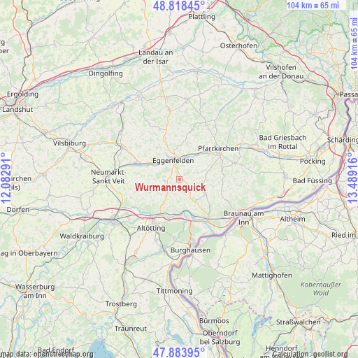
Wurmannsquick GPS coordinates[2]
48° 21' 12.024" North, 12° 47' 9.708" East
| Map corner | latitude | longitude |
|---|---|---|
| Upper-left | 48.81845°, | 12.08291° |
| Center: | 48.35334°, | 12.78603° |
| Lower-right: | 47.88395°, | 13.48916° |
| Map W x H: | 103.9×103.9 km | = 64.6×64.6mi |
| max Lat: | 55.01917° ⇑90.7% North |
| Wurmannsquick: | 48.35334° |
| min Lat: | ⇓9.3% South 47.40724° |
| min Long | Wurmannsquick | max Long |
| 5.92978° | 12.78603° | 14.98853° |
| W 90.6%⇐ | ⇒9.4% E |
Elevation
Elevation of Wurmannsquick is 497 m = 1631 ft, and this is 247.9 m = 813 ft above average elevation for this country.
| Max E: |
1256 m = 4121 ft | 11.7% |
| Wurmannsquick | 497 m 1631 ft | |
| Avg. | 249.1 m = 817 ft | |
Min E: |
-5 m = -16 ft | 88.3% |
See also: Germany elevation on elevation.city.
Geographical zone
Wurmannsquick is located in North temperate zone (between Tropic of Cancer and the Arctic Circle). Distance of this North polar circle is 2024.8 km =1258.2 mi to North.| Distance of | km | miles | from Wurmannsquick |
|---|---|---|---|
| North Pole | 4630.7 | 2877.4 | to North |
| Arctic Circle | 2024.8 | 1258.2 | to North |
| Tropic Cancer | 2770.5 | 1721.5 | to South |
| Equator | 5376.4 | 3340.7 | to South |


Nearby cities:
15 places around Wurmannsquick: (largest is in red/bold)
• Eggenfelden
6.1 km =3.8 mi,  339°
339°
• Erlbach
5.9 km =3.7 mi,  181°
181°
• Falkenberg
12.7 km =7.9 mi, 341°
• Geratskirchen
9.3 km =5.8 mi,  259°
259°
• Hebertsfelden
6.4 km =4 mi,  24°
24°
• Marktl
11.7 km =7.3 mi,  158°
158°
• Mitterskirchen
3.9 km =2.4 mi, 264°
• Perach
9.7 km =6 mi,  188°
188°
• Postmünster
11 km =6.8 mi,  50°
50°
• Reischach
8.2 km =5.1 mi,  212°
212°
• Reut
11.6 km =7.2 mi,  110°
110°
• Stammham
13.6 km =8.5 mi,  147°
147°
• Tann
9 km =5.6 mi,  118°
118°
• Unterdietfurt
9.4 km =5.8 mi,  290°
290°
• Zeilarn
7.3 km =4.5 mi,  144°
144°
Sources, notices
• [Note1] Compared only with cities in Germany existing in our database
• [Src1] Map data: © OpenStreetMap contributors (CC-BY-SA)
• [Src2] Other city data from geonames.org with taken over terms of usage.
• [Src3] Geographical zone / Annual Mean Temperature by Robert A. Rohde @ Wikipedia
