Tann geodata
Tann (Bavaria) is a populated place; located in Germany in Europe/Berlin (GMT+2) time zone. With population of 4,039 people, there are 3277 cities with bigger population in this country. Compared to other cities in Germany, 91.1% of cities are located further ↑North; 91.5% of cities are located further ←West and 82.1% of cities have lower elevation than Tann. Note1
Administrative division(s):
- Level 1: Bavaria
- Level 2: Lower Bavaria
- Level 3: Landkreis Rottal-Inn
- Level 4: Tann, Markt


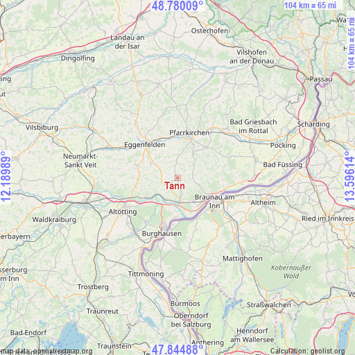
Tann GPS coordinates[2]
48° 18' 52.668" North, 12° 53' 34.836" East
| Map corner | latitude | longitude |
|---|---|---|
| Upper-left | 48.78009°, | 12.18989° |
| Center: | 48.31463°, | 12.89301° |
| Lower-right: | 47.84488°, | 13.59614° |
| Map W x H: | 104×104 km | = 64.6×64.6mi |
| max Lat: | 55.01917° ⇑91.1% North |
| Tann: | 48.31463° |
| min Lat: | ⇓8.9% South 47.40724° |
| min Long | Tann | max Long |
| 5.92978° | 12.89301° | 14.98853° |
| W 91.5%⇐ | ⇒8.5% E |
Elevation
Elevation of Tann is 447 m = 1467 ft, and this is 197.9 m = 649 ft above average elevation for this country.
| Max E: |
1256 m = 4121 ft | 17.9% |
| Tann | 447 m 1467 ft | |
| Avg. | 249.1 m = 817 ft | |
Min E: |
-5 m = -16 ft | 82.1% |
See also: Germany elevation on elevation.city.
Geographical zone
Tann is located in North temperate zone (between Tropic of Cancer and the Arctic Circle). Distance of this North polar circle is 2029.1 km =1260.8 mi to North.| Distance of | km | miles | from Tann |
|---|---|---|---|
| North Pole | 4635 | 2880.1 | to North |
| Arctic Circle | 2029.1 | 1260.8 | to North |
| Tropic Cancer | 2766.2 | 1718.8 | to South |
| Equator | 5372.1 | 3338.1 | to South |


Nearby cities:
15 places around Tann: (largest is in red/bold)
• Erlbach
8.3 km =5.2 mi,  258°
258°
• Haiming
10.9 km =6.8 mi,  177°
177°
• Hebertsfelden
11.4 km =7.1 mi,  332°
332°
• Julbach
8.3 km =5.2 mi,  144°
144°
• Kirchdorf am Inn
10.1 km =6.3 mi, 137°
• Marktl
7.5 km =4.7 mi,  208°
208°
• Perach
10.8 km =6.7 mi,  240°
240°
• Postmünster
11.4 km =7.1 mi,  2°
2°
• Reut
3 km =1.9 mi,  85°
85°
• Simbach am Inn
11.1 km =6.9 mi,  119°
119°
• Stammham
7.2 km =4.5 mi,  185°
185°
• Triftern
12.2 km =7.6 mi,  43°
43°
• Wittibreut
7.1 km =4.4 mi,  76°
76°
• Wurmannsquick
9 km =5.6 mi,  298°
298°
• Zeilarn
4.1 km =2.5 mi,  246°
246°
Sources, notices
• [Note1] Compared only with cities in Germany existing in our database
• [Src1] Map data: © OpenStreetMap contributors (CC-BY-SA)
• [Src2] Other city data from geonames.org with taken over terms of usage.
• [Src3] Geographical zone / Annual Mean Temperature by Robert A. Rohde @ Wikipedia
