Eggenfelden geodata
Eggenfelden (Bavaria) is a populated place; located in Germany in Europe/Berlin (GMT+2) time zone. With population of 12,860 people, there are 1256 cities with bigger population in this country. Compared to other cities in Germany, 90.2% of cities are located further ↑North; 90.4% of cities are located further ←West and 75.9% of cities have lower elevation than Eggenfelden. Note1
Administrative division(s):
- Level 1: Bavaria
- Level 2: Lower Bavaria
- Level 3: Landkreis Rottal-Inn
- Level 4: Eggenfelden


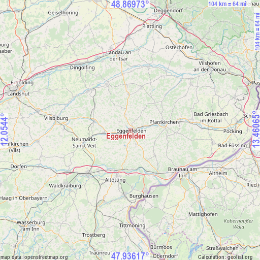
Eggenfelden GPS coordinates[2]
48° 24' 18.324" North, 12° 45' 27.072" East
| Map corner | latitude | longitude |
|---|---|---|
| Upper-left | 48.86973°, | 12.0544° |
| Center: | 48.40509°, | 12.75752° |
| Lower-right: | 47.93617°, | 13.46065° |
| Map W x H: | 103.8×103.8 km | = 64.5×64.5mi |
| max Lat: | 55.01917° ⇑90.2% North |
| Eggenfelden: | 48.40509° |
| min Lat: | ⇓9.8% South 47.40724° |
| min Long | Eggenfelden | max Long |
| 5.92978° | 12.75752° | 14.98853° |
| W 90.4%⇐ | ⇒9.6% E |
Elevation
Elevation of Eggenfelden is 405 m = 1329 ft, and this is 155.9 m = 511 ft above average elevation for this country.
| Max E: |
1256 m = 4121 ft | 24.1% |
| Eggenfelden | 405 m 1329 ft | |
| Avg. | 249.1 m = 817 ft | |
Min E: |
-5 m = -16 ft | 75.9% |
See also: Germany elevation on elevation.city.
Geographical zone
Eggenfelden is located in North temperate zone (between Tropic of Cancer and the Arctic Circle). Distance of this North polar circle is 2019 km =1254.5 mi to North.| Distance of | km | miles | from Eggenfelden |
|---|---|---|---|
| North Pole | 4624.9 | 2873.8 | to North |
| Arctic Circle | 2019 | 1254.5 | to North |
| Tropic Cancer | 2776.2 | 1725.1 | to South |
| Equator | 5382.1 | 3344.3 | to South |


Nearby cities:
15 places around Eggenfelden: (largest is in red/bold)
• Erlbach
11.8 km =7.3 mi,  170°
170°
• Falkenberg
6.6 km =4.1 mi,  342°
342°
• Geratskirchen
10.2 km =6.3 mi,  223°
223°
• Hebertsfelden
4.8 km =3 mi,  88°
88°
• Massing
11 km =6.8 mi,  261°
261°
• Mitterskirchen
6.4 km =4 mi,  196°
196°
• Pfarrkirchen
13.7 km =8.5 mi,  77°
77°
• Postmünster
10.6 km =6.6 mi, 83°
• Reischach
12.9 km =8 mi,  190°
190°
• Rimbach
10.5 km =6.5 mi,  310°
310°
• Schönau
11.1 km =6.9 mi,  38°
38°
• Tann
14.2 km =8.8 mi,  135°
135°
• Unterdietfurt
7.1 km =4.4 mi,  250°
250°
• Wurmannsquick
6.1 km =3.8 mi,  159°
159°
• Zeilarn
13.3 km =8.3 mi,  151°
151°
Sources, notices
• [Note1] Compared only with cities in Germany existing in our database
• [Src1] Map data: © OpenStreetMap contributors (CC-BY-SA)
• [Src2] Other city data from geonames.org with taken over terms of usage.
• [Src3] Geographical zone / Annual Mean Temperature by Robert A. Rohde @ Wikipedia
