Wolmirsleben geodata
Wolmirsleben (Saxony-Anhalt) is a seat of a fourth-order administrative division; located in Germany in Europe/Berlin (GMT+2) time zone. With population of 1,544 people, there are 5789 cities with bigger population in this country. Compared to other cities in Germany, 71.6% of cities are located further ↓South; 74% of cities are located further ←West and 71.8% of cities have higher elevation than Wolmirsleben. Note1


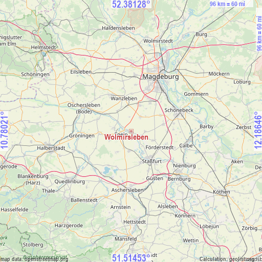
Wolmirsleben GPS coordinates[2]
51° 57' 0" North, 11° 28' 59.988" East
| Map corner | latitude | longitude |
|---|---|---|
| Upper-left | 52.38128°, | 10.78021° |
| Center: | 51.95°, | 11.48333° |
| Lower-right: | 51.51453°, | 12.18646° |
| Map W x H: | 96.4×96.4 km | = 59.9×59.9mi |
| max Lat: | 55.01917° ⇑28.4% North |
| Wolmirsleben: | 51.95° |
| min Lat: | ⇓71.6% South 47.40724° |
| min Long | Wolmirsleben | max Long |
| 5.92978° | 11.48333° | 14.98853° |
| W 74%⇐ | ⇒26% E |
Elevation
Elevation of Wolmirsleben is 79 m = 259 ft, and this is 170.1 m = 558 ft below average elevation for this country.
| Max E: |
1256 m = 4121 ft | 71.8% |
| Avg. | 249.1 m = 817 ft | |
| Wolmirsleben | 79 m = 259 ft | |
Min E: |
-5 m = -16 ft | 28.2% |
See also: Germany elevation on elevation.city.
Geographical zone
Wolmirsleben is located in North temperate zone (between Tropic of Cancer and the Arctic Circle). Distance of this North polar circle is 1624.9 km =1009.7 mi to North.| Distance of | km | miles | from Wolmirsleben |
|---|---|---|---|
| North Pole | 4230.8 | 2628.9 | to North |
| Arctic Circle | 1624.9 | 1009.7 | to North |
| Tropic Cancer | 3170.4 | 1970 | to South |
| Equator | 5776.3 | 3589.2 | to South |


Nearby cities:
15 places around Wolmirsleben: (largest is in red/bold)
• Atzendorf
8.6 km =5.3 mi,  113°
113°
• Biere
12 km =7.5 mi,  77°
77°
• Borne
5.2 km =3.2 mi,  91°
91°
• Bottmersdorf
9.7 km =6 mi,  337°
337°
• Cochstedt
9 km =5.6 mi,  213°
213°
• Egeln
3.5 km =2.2 mi,  258°
258°
• Etgersleben
5.8 km =3.6 mi,  303°
303°
• Förderstedt
11.9 km =7.4 mi,  119°
119°
• Groß Börnecke
7.3 km =4.5 mi,  187°
187°
• Hakeborn
8.8 km =5.5 mi,  246°
246°
• Hecklingen
12 km =7.5 mi,  163°
163°
• Schneidlingen
6.7 km =4.2 mi,  203°
203°
• Tarthun
2.1 km =1.3 mi, 199°
• Unseburg
2.8 km =1.7 mi,  133°
133°
• Westeregeln
6.4 km =4 mi,  283°
283°
Sources, notices
• [Note1] Compared only with cities in Germany existing in our database
• [Src1] Map data: © OpenStreetMap contributors (CC-BY-SA)
• [Src2] Other city data from geonames.org with taken over terms of usage.
• [Src3] Geographical zone / Annual Mean Temperature by Robert A. Rohde @ Wikipedia
