Borne geodata
Borne (Saxony-Anhalt) is a seat of a fourth-order administrative division; located in Germany in Europe/Berlin (GMT+2) time zone. With population of 1,415 people, there are 6051 cities with bigger population in this country. Compared to other cities in Germany, 71.6% of cities are located further ↓South; 75.1% of cities are located further ←West and 70% of cities have higher elevation than Borne. Note1


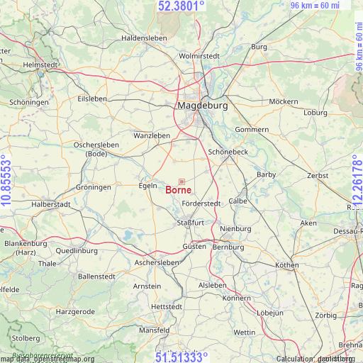
Borne GPS coordinates[2]
51° 56' 55.716" North, 11° 33' 31.14" East
| Map corner | latitude | longitude |
|---|---|---|
| Upper-left | 52.3801°, | 10.85553° |
| Center: | 51.94881°, | 11.55865° |
| Lower-right: | 51.51333°, | 12.26178° |
| Map W x H: | 96.4×96.4 km | = 59.9×59.9mi |
| max Lat: | 55.01917° ⇑28.4% North |
| Borne: | 51.94881° |
| min Lat: | ⇓71.6% South 47.40724° |
| min Long | Borne | max Long |
| 5.92978° | 11.55865° | 14.98853° |
| W 75.1%⇐ | ⇒24.9% E |
Elevation
Elevation of Borne is 91 m = 299 ft, and this is 158.1 m = 519 ft below average elevation for this country.
| Max E: |
1256 m = 4121 ft | 70% |
| Avg. | 249.1 m = 817 ft | |
| Borne | 91 m = 299 ft | |
Min E: |
-5 m = -16 ft | 30% |
See also: Germany elevation on elevation.city.
Geographical zone
Borne is located in North temperate zone (between Tropic of Cancer and the Arctic Circle). Distance of this North polar circle is 1625 km =1009.7 mi to North.| Distance of | km | miles | from Borne |
|---|---|---|---|
| North Pole | 4230.9 | 2629 | to North |
| Arctic Circle | 1625 | 1009.7 | to North |
| Tropic Cancer | 3170.2 | 1969.9 | to South |
| Equator | 5776.2 | 3589.2 | to South |


Nearby cities:
15 places around Borne: (largest is in red/bold)
• Atzendorf
4.3 km =2.7 mi,  139°
139°
• Biere
7.1 km =4.4 mi,  66°
66°
• Egeln
8.7 km =5.4 mi,  266°
266°
• Eggersdorf
10.8 km =6.7 mi, 73°
• Eickendorf
8 km =5 mi,  90°
90°
• Etgersleben
10.6 km =6.6 mi,  288°
288°
• Förderstedt
7.7 km =4.8 mi, 138°
• Glöthe
9.1 km =5.7 mi,  118°
118°
• Groß Börnecke
9.4 km =5.8 mi,  220°
220°
• Schneidlingen
9.9 km =6.2 mi,  232°
232°
• Staßfurt
10.9 km =6.8 mi,  170°
170°
• Tarthun
6.1 km =3.8 mi,  252°
252°
• Unseburg
3.6 km =2.2 mi,  240°
240°
• Welsleben
8.1 km =5 mi,  42°
42°
• Wolmirsleben
5.2 km =3.2 mi, 271°
Sources, notices
• [Note1] Compared only with cities in Germany existing in our database
• [Src1] Map data: © OpenStreetMap contributors (CC-BY-SA)
• [Src2] Other city data from geonames.org with taken over terms of usage.
• [Src3] Geographical zone / Annual Mean Temperature by Robert A. Rohde @ Wikipedia
