Etgersleben geodata
Etgersleben (Saxony-Anhalt) is a populated place; located in Germany in Europe/Berlin (GMT+2) time zone. With population of 818 people, there are 7833 cities with bigger population in this country. Compared to other cities in Germany, 71.9% of cities are located further ↓South; 72.8% of cities are located further ←West and 72.1% of cities have higher elevation than Etgersleben. Note1


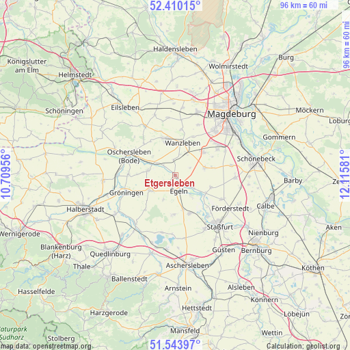
Etgersleben GPS coordinates[2]
51° 58' 44.94" North, 11° 24' 45.648" East
| Map corner | latitude | longitude |
|---|---|---|
| Upper-left | 52.41015°, | 10.70956° |
| Center: | 51.97915°, | 11.41268° |
| Lower-right: | 51.54397°, | 12.11581° |
| Map W x H: | 96.3×96.3 km | = 59.8×59.8mi |
| max Lat: | 55.01917° ⇑28.1% North |
| Etgersleben: | 51.97915° |
| min Lat: | ⇓71.9% South 47.40724° |
| min Long | Etgersleben | max Long |
| 5.92978° | 11.41268° | 14.98853° |
| W 72.8%⇐ | ⇒27.2% E |
Elevation
Elevation of Etgersleben is 77 m = 253 ft, and this is 172.1 m = 565 ft below average elevation for this country.
| Max E: |
1256 m = 4121 ft | 72.1% |
| Avg. | 249.1 m = 817 ft | |
| Etgersleben | 77 m = 253 ft | |
Min E: |
-5 m = -16 ft | 27.9% |
See also: Germany elevation on elevation.city.
Geographical zone
Etgersleben is located in North temperate zone (between Tropic of Cancer and the Arctic Circle). Distance of this North polar circle is 1621.6 km =1007.6 mi to North.| Distance of | km | miles | from Etgersleben |
|---|---|---|---|
| North Pole | 4227.5 | 2626.8 | to North |
| Arctic Circle | 1621.6 | 1007.6 | to North |
| Tropic Cancer | 3173.6 | 1972 | to South |
| Equator | 5779.5 | 3591.2 | to South |


Nearby cities:
15 places around Etgersleben: (largest is in red/bold)
• Borne
10.6 km =6.6 mi,  108°
108°
• Bottmersdorf
5.8 km =3.6 mi,  11°
11°
• Cochstedt
10.8 km =6.7 mi,  180°
180°
• Egeln
4.2 km =2.6 mi,  160°
160°
• Groß Börnecke
11.2 km =7 mi, 159°
• Hadmersleben
7.7 km =4.8 mi,  281°
281°
• Hakeborn
7.5 km =4.7 mi,  205°
205°
• Klein Wanzleben
10.6 km =6.6 mi,  342°
342°
• Kroppenstedt
8.2 km =5.1 mi,  240°
240°
• Schneidlingen
9.7 km =6 mi,  166°
166°
• Tarthun
6.6 km =4.1 mi,  141°
141°
• Unseburg
8.6 km =5.3 mi,  126°
126°
• Wanzleben
9.3 km =5.8 mi, 11°
• Westeregeln
2.2 km =1.4 mi,  217°
217°
• Wolmirsleben
5.8 km =3.6 mi,  123°
123°
Sources, notices
• [Note1] Compared only with cities in Germany existing in our database
• [Src1] Map data: © OpenStreetMap contributors (CC-BY-SA)
• [Src2] Other city data from geonames.org with taken over terms of usage.
• [Src3] Geographical zone / Annual Mean Temperature by Robert A. Rohde @ Wikipedia
