Woggersin geodata
Woggersin (Mecklenburg-Vorpommern) is a populated place; located in Germany in Europe/Berlin (GMT+2) time zone. With population of 572 people, there are 8959 cities with bigger population in this country. Compared to other cities in Germany, 87.1% of cities are located further ↓South; 93.9% of cities are located further ←West and 87.7% of cities have higher elevation than Woggersin. Note1
Administrative division(s):
- Level 1: Mecklenburg-Vorpommern
- Level 3: Mecklenburgische Seenplatte
- Level 4: Woggersin


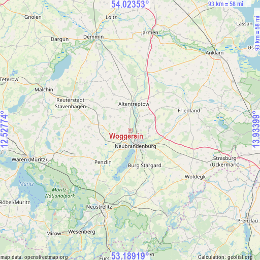
Woggersin GPS coordinates[2]
53° 36' 30.312" North, 13° 13' 51.096" East
| Map corner | latitude | longitude |
|---|---|---|
| Upper-left | 54.02353°, | 12.52774° |
| Center: | 53.60842°, | 13.23086° |
| Lower-right: | 53.18919°, | 13.93399° |
| Map W x H: | 92.8×92.8 km | = 57.7×57.7mi |
| max Lat: | 55.01917° ⇑12.9% North |
| Woggersin: | 53.60842° |
| min Lat: | ⇓87.1% South 47.40724° |
| min Long | Woggersin | max Long |
| 5.92978° | 13.23086° | 14.98853° |
| W 93.9%⇐ | ⇒6.1% E |
Elevation
Elevation of Woggersin is 28 m = 92 ft, and this is 221.1 m = 725 ft below average elevation for this country.
| Max E: |
1256 m = 4121 ft | 87.7% |
| Avg. | 249.1 m = 817 ft | |
| Woggersin | 28 m = 92 ft | |
Min E: |
-5 m = -16 ft | 12.3% |
See also: Germany elevation on elevation.city.
Geographical zone
Woggersin is located in North temperate zone (between Tropic of Cancer and the Arctic Circle). Distance of this North polar circle is 1440.5 km =895.1 mi to North.| Distance of | km | miles | from Woggersin |
|---|---|---|---|
| North Pole | 4046.4 | 2514.3 | to North |
| Arctic Circle | 1440.5 | 895.1 | to North |
| Tropic Cancer | 3354.8 | 2084.6 | to South |
| Equator | 5960.7 | 3703.8 | to South |


Nearby cities:
15 places around Woggersin: (largest is in red/bold)
• Altentreptow
9.8 km =6.1 mi,  13°
13°
• Blankenhof
7.4 km =4.6 mi,  242°
242°
• Breesen
4.9 km =3 mi,  299°
299°
• Brunn
11.5 km =7.1 mi,  52°
52°
• Groß Teetzleben
4.1 km =2.5 mi,  357°
357°
• Knorrendorf
11.2 km =7 mi,  283°
283°
• Mölln
9.8 km =6.1 mi,  258°
258°
• Neubrandenburg
5.7 km =3.5 mi,  149°
149°
• Neuenkirchen
9.2 km =5.7 mi,  97°
97°
• Neverin
7.1 km =4.4 mi,  78°
78°
• Reinberg
9.3 km =5.8 mi,  322°
322°
• Rossow
9.5 km =5.9 mi,  66°
66°
• Trollenhagen
4 km =2.5 mi,  92°
92°
• Wildberg
8.6 km =5.3 mi, 304°
• Wulkenzin
8.2 km =5.1 mi,  209°
209°
Sources, notices
• [Note1] Compared only with cities in Germany existing in our database
• [Src1] Map data: © OpenStreetMap contributors (CC-BY-SA)
• [Src2] Other city data from geonames.org with taken over terms of usage.
• [Src3] Geographical zone / Annual Mean Temperature by Robert A. Rohde @ Wikipedia
