Altentreptow geodata
Altentreptow (Mecklenburg-Vorpommern) is a populated place; located in Germany in Europe/Berlin (GMT+2) time zone. With population of 6,486 people, there are 2314 cities with bigger population in this country. Compared to other cities in Germany, 88.5% of cities are located further ↓South; 94.1% of cities are located further ←West and 90.1% of cities have higher elevation than Altentreptow. Note1
Administrative division(s):
- Level 1: Mecklenburg-Vorpommern
- Level 3: Mecklenburgische Seenplatte
- Level 4: Altentreptow


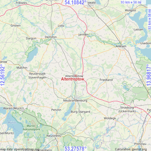
Altentreptow GPS coordinates[2]
53° 41' 38.976" North, 13° 15' 54.144" East
| Map corner | latitude | longitude |
|---|---|---|
| Upper-left | 54.10842°, | 12.56192° |
| Center: | 53.69416°, | 13.26504° |
| Lower-right: | 53.27578°, | 13.96817° |
| Map W x H: | 92.6×92.6 km | = 57.5×57.5mi |
| max Lat: | 55.01917° ⇑11.5% North |
| Altentreptow: | 53.69416° |
| min Lat: | ⇓88.5% South 47.40724° |
| min Long | Altentreptow | max Long |
| 5.92978° | 13.26504° | 14.98853° |
| W 94.1%⇐ | ⇒5.9% E |
Elevation
Elevation of Altentreptow is 21 m = 69 ft, and this is 228.1 m = 748 ft below average elevation for this country.
| Max E: |
1256 m = 4121 ft | 90.1% |
| Avg. | 249.1 m = 817 ft | |
| Altentreptow | 21 m = 69 ft | |
Min E: |
-5 m = -16 ft | 9.9% |
See also: Germany elevation on elevation.city.
Geographical zone
Altentreptow is located in North temperate zone (between Tropic of Cancer and the Arctic Circle). Distance of this North polar circle is 1430.9 km =889.1 mi to North.| Distance of | km | miles | from Altentreptow |
|---|---|---|---|
| North Pole | 4036.8 | 2508.4 | to North |
| Arctic Circle | 1430.9 | 889.1 | to North |
| Tropic Cancer | 3364.3 | 2090.5 | to South |
| Equator | 5970.2 | 3709.7 | to South |


Nearby cities:
15 places around Altentreptow: (largest is in red/bold)
• Breesen
9.7 km =6 mi,  222°
222°
• Brunn
7.4 km =4.6 mi,  110°
110°
• Burow
8.9 km =5.5 mi,  3°
3°
• Groß Teetzleben
6 km =3.7 mi,  204°
204°
• Gültz
8.1 km =5 mi,  320°
320°
• Gützkow
11 km =6.8 mi,  287°
287°
• Kessin
4.8 km =3 mi,  35°
35°
• Neverin
9.4 km =5.8 mi,  150°
150°
• Reinberg
8.2 km =5.1 mi,  254°
254°
• Rossow
8.7 km =5.4 mi,  131°
131°
• Siedenbollentin
8.8 km =5.5 mi,  60°
60°
• Trollenhagen
9.8 km =6.1 mi,  169°
169°
• Tützpatz
8.7 km =5.4 mi, 292°
• Wildberg
10.4 km =6.5 mi,  243°
243°
• Woggersin
9.8 km =6.1 mi,  193°
193°
Sources, notices
• [Note1] Compared only with cities in Germany existing in our database
• [Src1] Map data: © OpenStreetMap contributors (CC-BY-SA)
• [Src2] Other city data from geonames.org with taken over terms of usage.
• [Src3] Geographical zone / Annual Mean Temperature by Robert A. Rohde @ Wikipedia
