Neubrandenburg geodata
Neubrandenburg (Mecklenburg-Vorpommern) is a seat of a third-order administrative division; located in Germany in Europe/Berlin (GMT+2) time zone. With population of 68,082 people, there are 152 cities with bigger population in this country. Compared to other cities in Germany, 86.4% of cities are located further ↓South; 94.2% of cities are located further ←West and 91.2% of cities have higher elevation than Neubrandenburg. Note1
Administrative division(s):
- Level 1: Mecklenburg-Vorpommern
- Level 3: Mecklenburgische Seenplatte
- Level 4: Neubrandenburg


Neubrandenburg GPS coordinates[2]
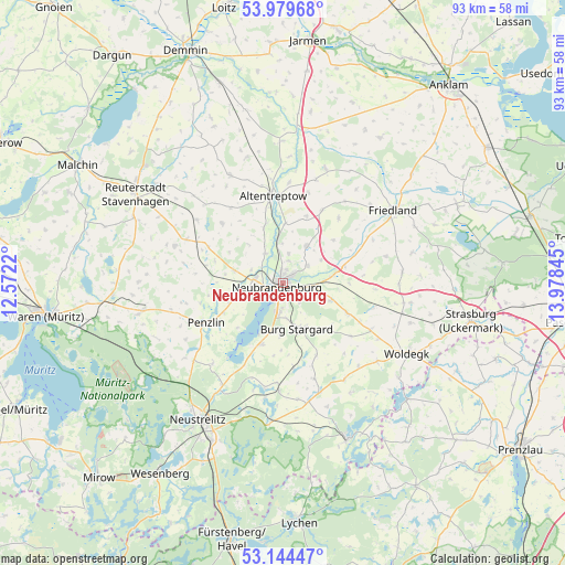
53° 33' 50.904" North, 13° 16' 31.152" East
| Map corner | latitude | longitude |
|---|---|---|
| Upper-left | 53.97968°, | 12.5722° |
| Center: | 53.56414°, | 13.27532° |
| Lower-right: | 53.14447°, | 13.97845° |
| Map W x H: | 92.9×92.9 km | = 57.7×57.7mi |
| max Lat: | 55.01917° ⇑13.6% North |
| Neubrandenburg: | 53.56414° |
| min Lat: | ⇓86.4% South 47.40724° |
| min Long | Neubrandenburg | max Long |
| 5.92978° | 13.27532° | 14.98853° |
| W 94.2%⇐ | ⇒5.8% E |
Elevation
Elevation of Neubrandenburg is 18 m = 59 ft, and this is 231.1 m = 758 ft below average elevation for this country.
| Max E: |
1256 m = 4121 ft | 91.2% |
| Avg. | 249.1 m = 817 ft | |
| Neubrandenburg | 18 m = 59 ft | |
Min E: |
-5 m = -16 ft | 8.8% |
See also: Neubrandenburg elevation on elevation.city.
Geographical zone
Neubrandenburg is located in North temperate zone (between Tropic of Cancer and the Arctic Circle). Distance of this North polar circle is 1445.4 km =898.1 mi to North.| Distance of | km | miles | from Neubrandenburg |
|---|---|---|---|
| North Pole | 4051.3 | 2517.4 | to North |
| Arctic Circle | 1445.4 | 898.1 | to North |
| Tropic Cancer | 3349.9 | 2081.5 | to South |
| Equator | 5955.8 | 3700.8 | to South |


Nearby cities:
15 places around Neubrandenburg: (largest is in red/bold)
• Blankenhof
9.6 km =6 mi,  279°
279°
• Breesen
10.3 km =6.4 mi,  315°
315°
• Burg Stargard
8 km =5 mi,  162°
162°
• Cölpin
11.6 km =7.2 mi,  114°
114°
• Groß Nemerow
10.6 km =6.6 mi,  198°
198°
• Groß Teetzleben
9.5 km =5.9 mi,  340°
340°
• Holldorf
11 km =6.8 mi,  181°
181°
• Neuenkirchen
7.2 km =4.5 mi,  59°
59°
• Neverin
7.5 km =4.7 mi,  32°
32°
• Pragsdorf
8.4 km =5.2 mi, 109°
• Rossow
10.5 km =6.5 mi, 33°
• Staven
11 km =6.8 mi,  50°
50°
• Trollenhagen
4.9 km =3 mi,  12°
12°
• Woggersin
5.7 km =3.5 mi,  329°
329°
• Wulkenzin
7.3 km =4.5 mi,  252°
252°
In other languages:
- In Spanish: Nuevo Brandeburgo
- In France: Neubrandenbourg
- In Russian: Нойбранденбурге, Нойбранденбург
- In Chinese: 新勃兰登堡
Sources, notices
• [Note1] Compared only with cities in Germany existing in our database
• [Src1] Map data: © OpenStreetMap contributors (CC-BY-SA)
• [Src2] Other city data from geonames.org with taken over terms of usage.
• [Src3] Geographical zone / Annual Mean Temperature by Robert A. Rohde @ Wikipedia
