Winterhausen geodata
Winterhausen (Bavaria) is a populated place; located in Germany in Europe/Berlin (GMT+2) time zone. With population of 1,558 people, there are 5765 cities with bigger population in this country. Compared to other cities in Germany, 71.2% of cities are located further ↑North; 50.3% of cities are located further ←West and 55.8% of cities have higher elevation than Winterhausen. Note1
Administrative division(s):
- Level 1: Bavaria
- Level 2: Regierungsbezirk Unterfranken
- Level 3: Landkreis Würzburg
- Level 4: Winterhausen, Markt


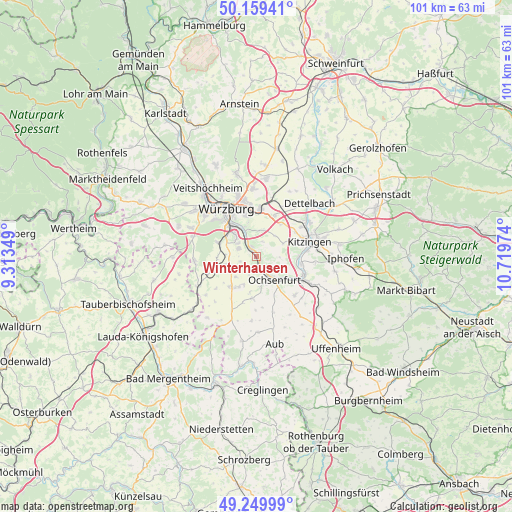
Winterhausen GPS coordinates[2]
49° 42' 24.588" North, 10° 0' 59.796" East
| Map corner | latitude | longitude |
|---|---|---|
| Upper-left | 50.15941°, | 9.31349° |
| Center: | 49.70683°, | 10.01661° |
| Lower-right: | 49.24999°, | 10.71974° |
| Map W x H: | 101.1×101.1 km | = 62.8×62.8mi |
| max Lat: | 55.01917° ⇑71.2% North |
| Winterhausen: | 49.70683° |
| min Lat: | ⇓28.8% South 47.40724° |
| min Long | Winterhausen | max Long |
| 5.92978° | 10.01661° | 14.98853° |
| W 50.3%⇐ | ⇒49.7% E |
Elevation
Elevation of Winterhausen is 183 m = 600 ft, and this is 66.1 m = 217 ft below average elevation for this country.
| Max E: |
1256 m = 4121 ft | 55.8% |
| Avg. | 249.1 m = 817 ft | |
| Winterhausen | 183 m = 600 ft | |
Min E: |
-5 m = -16 ft | 44.2% |
See also: Germany elevation on elevation.city.
Geographical zone
Winterhausen is located in North temperate zone (between Tropic of Cancer and the Arctic Circle). Distance of this North polar circle is 1874.3 km =1164.6 mi to North.| Distance of | km | miles | from Winterhausen |
|---|---|---|---|
| North Pole | 4480.2 | 2783.9 | to North |
| Arctic Circle | 1874.3 | 1164.6 | to North |
| Tropic Cancer | 2921 | 1815 | to South |
| Equator | 5526.9 | 3434.3 | to South |


Nearby cities:
15 places around Winterhausen: (largest is in red/bold)
• Biebelried
8.2 km =5.1 mi,  35°
35°
• Eibelstadt
2.3 km =1.4 mi,  327°
327°
• Frickenhausen
6.8 km =4.2 mi,  126°
126°
• Gaukönigshofen
8.3 km =5.2 mi,  188°
188°
• Gerbrunn
7.8 km =4.8 mi,  347°
347°
• Geroldshausen
8.6 km =5.3 mi,  252°
252°
• Giebelstadt
7.9 km =4.9 mi,  220°
220°
• Marktsteft
8.7 km =5.4 mi,  97°
97°
• Ochsenfurt
5.8 km =3.6 mi,  145°
145°
• Randersacker
6.4 km =4 mi,  337°
337°
• Reichenberg
7.8 km =4.8 mi,  290°
290°
• Rottendorf
9.5 km =5.9 mi,  4°
4°
• Sommerhausen
0.8 km =0.5 mi,  117°
117°
• Sulzfeld am Main
8.3 km =5.2 mi,  89°
89°
• Theilheim
5.3 km =3.3 mi,  10°
10°
Sources, notices
• [Note1] Compared only with cities in Germany existing in our database
• [Src1] Map data: © OpenStreetMap contributors (CC-BY-SA)
• [Src2] Other city data from geonames.org with taken over terms of usage.
• [Src3] Geographical zone / Annual Mean Temperature by Robert A. Rohde @ Wikipedia
