Rottendorf geodata
Rottendorf (Bavaria) is a seat of a fourth-order administrative division; located in Germany in Europe/Berlin (GMT+2) time zone. With population of 5,234 people, there are 2722 cities with bigger population in this country. Compared to other cities in Germany, 69.2% of cities are located further ↑North; 50.6% of cities are located further ←West and 53.9% of cities have lower elevation than Rottendorf. Note1
Administrative division(s):
- Level 1: Bavaria
- Level 2: Regierungsbezirk Unterfranken
- Level 3: Landkreis Würzburg
- Level 4: Rottendorf


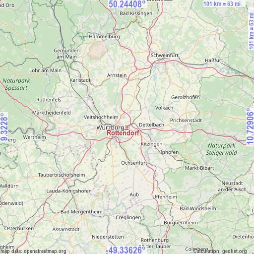
Rottendorf GPS coordinates[2]
49° 47' 32.28" North, 10° 1' 33.348" East
| Map corner | latitude | longitude |
|---|---|---|
| Upper-left | 50.24408°, | 9.3228° |
| Center: | 49.7923°, | 10.02593° |
| Lower-right: | 49.33626°, | 10.72906° |
| Map W x H: | 100.9×100.9 km | = 62.7×62.7mi |
| max Lat: | 55.01917° ⇑69.2% North |
| Rottendorf: | 49.7923° |
| min Lat: | ⇓30.8% South 47.40724° |
| min Long | Rottendorf | max Long |
| 5.92978° | 10.02593° | 14.98853° |
| W 50.6%⇐ | ⇒49.4% E |
Elevation
Elevation of Rottendorf is 251 m = 823 ft, and this is 1.9 m = 6 ft above average elevation for this country.
| Max E: |
1256 m = 4121 ft | 46.1% |
| Rottendorf | 251 m 823 ft | |
| Avg. | 249.1 m = 817 ft | |
Min E: |
-5 m = -16 ft | 53.9% |
See also: Germany elevation on elevation.city.
Geographical zone
Rottendorf is located in North temperate zone (between Tropic of Cancer and the Arctic Circle). Distance of this North polar circle is 1864.8 km =1158.7 mi to North.| Distance of | km | miles | from Rottendorf |
|---|---|---|---|
| North Pole | 4470.7 | 2778 | to North |
| Arctic Circle | 1864.8 | 1158.7 | to North |
| Tropic Cancer | 2930.5 | 1820.9 | to South |
| Equator | 5536.4 | 3440.2 | to South |


Nearby cities:
15 places around Rottendorf: (largest is in red/bold)
• Biebelried
5 km =3.1 mi,  124°
124°
• Buchbrunn
8.7 km =5.4 mi,  114°
114°
• Dettelbach
10.1 km =6.3 mi,  83°
83°
• Eibelstadt
7.8 km =4.8 mi,  193°
193°
• Estenfeld
4.3 km =2.7 mi,  340°
340°
• Gerbrunn
3 km =1.9 mi,  230°
230°
• Kürnach
6.4 km =4 mi,  4°
4°
• Mainstockheim
9.1 km =5.7 mi,  104°
104°
• Randersacker
4.7 km =2.9 mi,  220°
220°
• Rimpar
8.7 km =5.4 mi,  325°
325°
• Sommerhausen
9.9 km =6.2 mi,  179°
179°
• Theilheim
4.3 km =2.7 mi, 175°
• Unterpleichfeld
8.6 km =5.3 mi,  8°
8°
• Winterhausen
9.5 km =5.9 mi, 184°
• Würzburg
5.4 km =3.4 mi,  271°
271°
Sources, notices
• [Note1] Compared only with cities in Germany existing in our database
• [Src1] Map data: © OpenStreetMap contributors (CC-BY-SA)
• [Src2] Other city data from geonames.org with taken over terms of usage.
• [Src3] Geographical zone / Annual Mean Temperature by Robert A. Rohde @ Wikipedia
