Winterfeld geodata
Winterfeld (Saxony-Anhalt) is a populated place; located in Germany in Europe/Berlin (GMT+2) time zone. With population of 638 people, there are 8609 cities with bigger population in this country. Compared to other cities in Germany, 80% of cities are located further ↓South; 70.6% of cities are located further ←West and 83.2% of cities have higher elevation than Winterfeld. Note1
Administrative division(s):
- Level 1: Saxony-Anhalt
- Level 3: Altmarkkreis Salzwedel
- Level 4: Apenburg-Winterfeld, Flecken


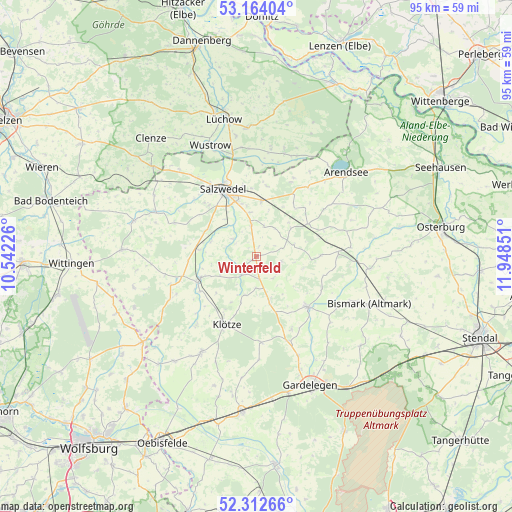
Winterfeld GPS coordinates[2]
52° 44' 25.548" North, 11° 14' 43.368" East
| Map corner | latitude | longitude |
|---|---|---|
| Upper-left | 53.16404°, | 10.54226° |
| Center: | 52.74043°, | 11.24538° |
| Lower-right: | 52.31266°, | 11.94851° |
| Map W x H: | 94.7×94.7 km | = 58.8×58.8mi |
| max Lat: | 55.01917° ⇑20% North |
| Winterfeld: | 52.74043° |
| min Lat: | ⇓80% South 47.40724° |
| min Long | Winterfeld | max Long |
| 5.92978° | 11.24538° | 14.98853° |
| W 70.6%⇐ | ⇒29.4% E |
Elevation
Elevation of Winterfeld is 39 m = 128 ft, and this is 210.1 m = 689 ft below average elevation for this country.
| Max E: |
1256 m = 4121 ft | 83.2% |
| Avg. | 249.1 m = 817 ft | |
| Winterfeld | 39 m = 128 ft | |
Min E: |
-5 m = -16 ft | 16.8% |
See also: Germany elevation on elevation.city.
Geographical zone
Winterfeld is located in North temperate zone (between Tropic of Cancer and the Arctic Circle). Distance of this North polar circle is 1537 km =955 mi to North.| Distance of | km | miles | from Winterfeld |
|---|---|---|---|
| North Pole | 4142.9 | 2574.3 | to North |
| Arctic Circle | 1537 | 955 | to North |
| Tropic Cancer | 3258.3 | 2024.6 | to South |
| Equator | 5864.2 | 3643.8 | to South |


Nearby cities:
15 places around Winterfeld: (largest is in red/bold)
• Apenburg
4.2 km =2.6 mi,  219°
219°
• Bandau
11.9 km =7.4 mi,  229°
229°
• Beetzendorf
11.4 km =7.1 mi,  248°
248°
• Brunau
15 km =9.3 mi,  86°
86°
• Bühne
8.8 km =5.5 mi,  128°
128°
• Engersen
14.9 km =9.3 mi,  154°
154°
• Fleetmark
11.3 km =7 mi,  58°
58°
• Kakerbeck
8.2 km =5.1 mi,  164°
164°
• Kalbe
13.2 km =8.2 mi, 134°
• Klötze
13.7 km =8.5 mi,  203°
203°
• Kuhfelde
9.9 km =6.2 mi,  298°
298°
• Pretzier
10.3 km =6.4 mi,  5°
5°
• Rohrberg
14.2 km =8.8 mi,  255°
255°
• Salzwedel
14.1 km =8.8 mi,  333°
333°
• Wallstawe
16.8 km =10.4 mi,  293°
293°
Sources, notices
• [Note1] Compared only with cities in Germany existing in our database
• [Src1] Map data: © OpenStreetMap contributors (CC-BY-SA)
• [Src2] Other city data from geonames.org with taken over terms of usage.
• [Src3] Geographical zone / Annual Mean Temperature by Robert A. Rohde @ Wikipedia
