Kuhfelde geodata
Kuhfelde (Saxony-Anhalt) is a seat of a fourth-order administrative division; located in Germany in Europe/Berlin (GMT+2) time zone. With population of 530 people, there are 9193 cities with bigger population in this country. Compared to other cities in Germany, 80.3% of cities are located further ↓South; 68.6% of cities are located further ←West and 81% of cities have higher elevation than Kuhfelde. Note1
Administrative division(s):
- Level 1: Saxony-Anhalt
- Level 3: Altmarkkreis Salzwedel
- Level 4: Kuhfelde


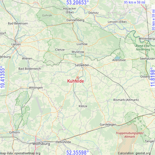
Kuhfelde GPS coordinates[2]
52° 46' 59.988" North, 11° 7' 0.012" East
| Map corner | latitude | longitude |
|---|---|---|
| Upper-left | 53.20653°, | 10.41355° |
| Center: | 52.78333°, | 11.11667° |
| Lower-right: | 52.35598°, | 11.8198° |
| Map W x H: | 94.6×94.6 km | = 58.8×58.8mi |
| max Lat: | 55.01917° ⇑19.7% North |
| Kuhfelde: | 52.78333° |
| min Lat: | ⇓80.3% South 47.40724° |
| min Long | Kuhfelde | max Long |
| 5.92978° | 11.11667° | 14.98853° |
| W 68.6%⇐ | ⇒31.4% E |
Elevation
Elevation of Kuhfelde is 44 m = 144 ft, and this is 205.1 m = 673 ft below average elevation for this country.
| Max E: |
1256 m = 4121 ft | 81% |
| Avg. | 249.1 m = 817 ft | |
| Kuhfelde | 44 m = 144 ft | |
Min E: |
-5 m = -16 ft | 19% |
See also: Germany elevation on elevation.city.
Geographical zone
Kuhfelde is located in North temperate zone (between Tropic of Cancer and the Arctic Circle). Distance of this North polar circle is 1532.2 km =952.1 mi to North.| Distance of | km | miles | from Kuhfelde |
|---|---|---|---|
| North Pole | 4138.1 | 2571.3 | to North |
| Arctic Circle | 1532.2 | 952.1 | to North |
| Tropic Cancer | 3263 | 2027.5 | to South |
| Equator | 5869 | 3646.8 | to South |


Nearby cities:
15 places around Kuhfelde: (largest is in red/bold)
• Apenburg
10 km =6.2 mi,  143°
143°
• Bandau
12.4 km =7.7 mi,  181°
181°
• Beetzendorf
9.2 km =5.7 mi,  191°
191°
• Bergen an der Dumme
16.1 km =10 mi,  318°
318°
• Dähre
14.2 km =8.8 mi,  276°
276°
• Henningen
12.2 km =7.6 mi,  302°
302°
• Kakerbeck
16.7 km =10.4 mi, 139°
• Lübbow
14.9 km =9.3 mi,  16°
16°
• Osterwohle
9.4 km =5.8 mi,  308°
308°
• Pretzier
11.1 km =6.9 mi,  60°
60°
• Rohrberg
9.9 km =6.2 mi,  211°
211°
• Salzwedel
8.3 km =5.2 mi, 16°
• Wallstawe
7 km =4.3 mi,  285°
285°
• Winterfeld
9.9 km =6.2 mi,  118°
118°
• Wustrow
15.6 km =9.7 mi,  2°
2°
Sources, notices
• [Note1] Compared only with cities in Germany existing in our database
• [Src1] Map data: © OpenStreetMap contributors (CC-BY-SA)
• [Src2] Other city data from geonames.org with taken over terms of usage.
• [Src3] Geographical zone / Annual Mean Temperature by Robert A. Rohde @ Wikipedia
