Fleetmark geodata
Fleetmark (Saxony-Anhalt) is a populated place; located in Germany in Europe/Berlin (GMT+2) time zone. With population of 764 people, there are 8032 cities with bigger population in this country. Compared to other cities in Germany, 80.4% of cities are located further ↓South; 72.6% of cities are located further ←West and 84.5% of cities have higher elevation than Fleetmark. Note1
Administrative division(s):
- Level 1: Saxony-Anhalt
- Level 3: Altmarkkreis Salzwedel
- Level 4: Arendsee (Altmark)


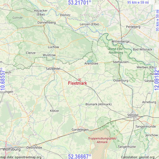
Fleetmark GPS coordinates[2]
52° 47' 38.112" North, 11° 23' 19.284" East
| Map corner | latitude | longitude |
|---|---|---|
| Upper-left | 53.21701°, | 10.68557° |
| Center: | 52.79392°, | 11.38869° |
| Lower-right: | 52.36667°, | 12.09182° |
| Map W x H: | 94.5×94.5 km | = 58.7×58.7mi |
| max Lat: | 55.01917° ⇑19.6% North |
| Fleetmark: | 52.79392° |
| min Lat: | ⇓80.4% South 47.40724° |
| min Long | Fleetmark | max Long |
| 5.92978° | 11.38869° | 14.98853° |
| W 72.6%⇐ | ⇒27.4% E |
Elevation
Elevation of Fleetmark is 36 m = 118 ft, and this is 213.1 m = 699 ft below average elevation for this country.
| Max E: |
1256 m = 4121 ft | 84.5% |
| Avg. | 249.1 m = 817 ft | |
| Fleetmark | 36 m = 118 ft | |
Min E: |
-5 m = -16 ft | 15.5% |
See also: Germany elevation on elevation.city.
Geographical zone
Fleetmark is located in North temperate zone (between Tropic of Cancer and the Arctic Circle). Distance of this North polar circle is 1531 km =951.3 mi to North.| Distance of | km | miles | from Fleetmark |
|---|---|---|---|
| North Pole | 4136.9 | 2570.5 | to North |
| Arctic Circle | 1531 | 951.3 | to North |
| Tropic Cancer | 3264.2 | 2028.3 | to South |
| Equator | 5870.1 | 3647.5 | to South |


Nearby cities:
15 places around Fleetmark: (largest is in red/bold)
• Apenburg
15.4 km =9.6 mi,  233°
233°
• Bismark
18.5 km =11.5 mi,  142°
142°
• Bretsch
17 km =10.6 mi,  72°
72°
• Brunau
7.4 km =4.6 mi,  133°
133°
• Bühne
11.8 km =7.3 mi,  193°
193°
• Kakerbeck
15.7 km =9.8 mi,  208°
208°
• Kalbe
15.3 km =9.5 mi,  181°
181°
• Kleinau
8.2 km =5.1 mi,  85°
85°
• Kuhfelde
18.3 km =11.4 mi,  266°
266°
• Luftkurort Arendsee
11.7 km =7.3 mi,  34°
34°
• Lückstedt
13.8 km =8.6 mi,  77°
77°
• Meßdorf
13.9 km =8.6 mi, 125°
• Pretzier
9.6 km =6 mi,  296°
296°
• Salzwedel
17.2 km =10.7 mi,  292°
292°
• Winterfeld
11.3 km =7 mi,  238°
238°
Sources, notices
• [Note1] Compared only with cities in Germany existing in our database
• [Src1] Map data: © OpenStreetMap contributors (CC-BY-SA)
• [Src2] Other city data from geonames.org with taken over terms of usage.
• [Src3] Geographical zone / Annual Mean Temperature by Robert A. Rohde @ Wikipedia
