Rohrberg geodata
Rohrberg (Saxony-Anhalt) is a seat of a fourth-order administrative division; located in Germany in Europe/Berlin (GMT+2) time zone. With population of 613 people, there are 8752 cities with bigger population in this country. Compared to other cities in Germany, 79.7% of cities are located further ↓South; 67.5% of cities are located further ←West and 80.6% of cities have higher elevation than Rohrberg. Note1
Administrative division(s):
- Level 1: Saxony-Anhalt
- Level 3: Altmarkkreis Salzwedel
- Level 4: Rohrberg


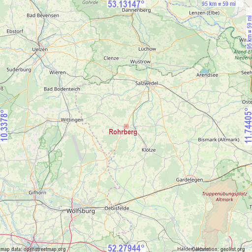
Rohrberg GPS coordinates[2]
52° 42' 27.108" North, 11° 2' 27.312" East
| Map corner | latitude | longitude |
|---|---|---|
| Upper-left | 53.13147°, | 10.3378° |
| Center: | 52.70753°, | 11.04092° |
| Lower-right: | 52.27944°, | 11.74405° |
| Map W x H: | 94.7×94.7 km | = 58.8×58.8mi |
| max Lat: | 55.01917° ⇑20.3% North |
| Rohrberg: | 52.70753° |
| min Lat: | ⇓79.7% South 47.40724° |
| min Long | Rohrberg | max Long |
| 5.92978° | 11.04092° | 14.98853° |
| W 67.5%⇐ | ⇒32.5% E |
Elevation
Elevation of Rohrberg is 45 m = 148 ft, and this is 204.1 m = 670 ft below average elevation for this country.
| Max E: |
1256 m = 4121 ft | 80.6% |
| Avg. | 249.1 m = 817 ft | |
| Rohrberg | 45 m = 148 ft | |
Min E: |
-5 m = -16 ft | 19.4% |
See also: Germany elevation on elevation.city.
Geographical zone
Rohrberg is located in North temperate zone (between Tropic of Cancer and the Arctic Circle). Distance of this North polar circle is 1540.6 km =957.3 mi to North.| Distance of | km | miles | from Rohrberg |
|---|---|---|---|
| North Pole | 4146.5 | 2576.5 | to North |
| Arctic Circle | 1540.6 | 957.3 | to North |
| Tropic Cancer | 3254.6 | 2022.3 | to South |
| Equator | 5860.5 | 3641.5 | to South |


Nearby cities:
15 places around Rohrberg: (largest is in red/bold)
• Apenburg
11.1 km =6.9 mi,  88°
88°
• Bandau
6.1 km =3.8 mi,  130°
130°
• Beetzendorf
3.3 km =2.1 mi,  100°
100°
• Brome
13.8 km =8.6 mi,  210°
210°
• Dähre
13.5 km =8.4 mi,  318°
318°
• Henningen
15.9 km =9.9 mi,  341°
341°
• Immekath
9.5 km =5.9 mi,  163°
163°
• Jübar
9.1 km =5.7 mi,  256°
256°
• Klötze
12.2 km =7.6 mi,  137°
137°
• Kuhfelde
9.9 km =6.2 mi,  31°
31°
• Kunrau
15.7 km =9.8 mi,  185°
185°
• Kusey
14.6 km =9.1 mi,  166°
166°
• Osterwohle
14.5 km =9 mi,  351°
351°
• Wallstawe
10.4 km =6.5 mi, 350°
• Winterfeld
14.2 km =8.8 mi,  75°
75°
Sources, notices
• [Note1] Compared only with cities in Germany existing in our database
• [Src1] Map data: © OpenStreetMap contributors (CC-BY-SA)
• [Src2] Other city data from geonames.org with taken over terms of usage.
• [Src3] Geographical zone / Annual Mean Temperature by Robert A. Rohde @ Wikipedia
