Winterbach geodata
Winterbach (Rheinland-Pfalz) is a populated place; located in Germany in Europe/Berlin (GMT+2) time zone. With population of 554 people, there are 9060 cities with bigger population in this country. Compared to other cities in Germany, 78.6% of cities are located further ↑North; 87.4% of cities are located further →East and 55.9% of cities have lower elevation than Winterbach. Note1
Administrative division(s):
- Level 1: Rheinland-Pfalz
- Level 3: Südwestpfalz
- Level 4: Winterbach (Pfalz)


Winterbach GPS coordinates[2]
49° 18' 10.98" North, 7° 28' 23.196" East
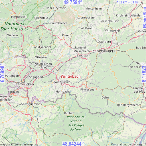
| Map corner | latitude | longitude |
|---|---|---|
| Upper-left | 49.7594°, | 6.76998° |
| Center: | 49.30305°, | 7.47311° |
| Lower-right: | 48.84244°, | 8.17623° |
| Map W x H: | 102×102 km | = 63.4×63.4mi |
| max Lat: | 55.01917° ⇑78.6% North |
| Winterbach: | 49.30305° |
| min Lat: | ⇓21.4% South 47.40724° |
| min Long | Winterbach | max Long |
| 5.92978° | 7.47311° | 14.98853° |
| W 12.6%⇐ | ⇒87.4% E |
Elevation
Elevation of Winterbach is 265 m = 869 ft, and this is 15.9 m = 52 ft above average elevation for this country.
| Max E: |
1256 m = 4121 ft | 44.1% |
| Winterbach | 265 m 869 ft | |
| Avg. | 249.1 m = 817 ft | |
Min E: |
-5 m = -16 ft | 55.9% |
See also: Germany elevation on elevation.city.
Geographical zone
Winterbach is located in North temperate zone (between Tropic of Cancer and the Arctic Circle). Distance of this North polar circle is 1919.2 km =1192.5 mi to North.| Distance of | km | miles | from Winterbach |
|---|---|---|---|
| North Pole | 4525.1 | 2811.8 | to North |
| Arctic Circle | 1919.2 | 1192.5 | to North |
| Tropic Cancer | 2876.1 | 1787.1 | to South |
| Equator | 5482 | 3406.4 | to South |


Nearby cities:
15 places around Winterbach: (largest is in red/bold)
• Battweiler
2.8 km =1.7 mi,  194°
194°
• Biedershausen
1.7 km =1.1 mi,  26°
26°
• Großbundenbach
4.1 km =2.5 mi,  265°
265°
• Herschberg
5.4 km =3.4 mi,  87°
87°
• Kleinbundenbach
3.3 km =2.1 mi,  297°
297°
• Knopp-Labach
3.9 km =2.4 mi, 30°
• Krähenberg
3.4 km =2.1 mi,  352°
352°
• Käshofen
5.3 km =3.3 mi,  309°
309°
• Maßweiler
6 km =3.7 mi,  132°
132°
• Reifenberg
3.5 km =2.2 mi, 130°
• Rosenkopf
6 km =3.7 mi,  331°
331°
• Saalstadt
5.8 km =3.6 mi,  74°
74°
• Schmitshausen
3.2 km =2 mi,  96°
96°
• Wallhalben
3.8 km =2.4 mi, 66°
• Wiesbach
3.8 km =2.4 mi, 333°
Sources, notices
• [Note1] Compared only with cities in Germany existing in our database
• [Src1] Map data: © OpenStreetMap contributors (CC-BY-SA)
• [Src2] Other city data from geonames.org with taken over terms of usage.
• [Src3] Geographical zone / Annual Mean Temperature by Robert A. Rohde @ Wikipedia
