Großbundenbach geodata
Großbundenbach (Rheinland-Pfalz) is a seat of a fourth-order administrative division; located in Germany in Europe/Berlin (GMT+2) time zone. With population of 399 people, there are 9695 cities with bigger population in this country. Compared to other cities in Germany, 78.7% of cities are located further ↑North; 88.4% of cities are located further →East and 65.1% of cities have lower elevation than Großbundenbach. Note1


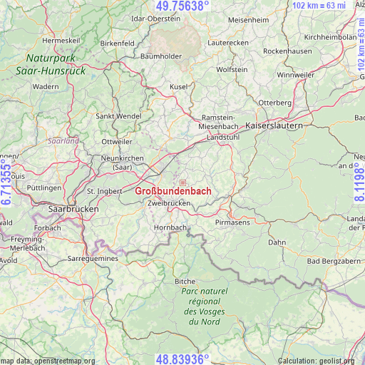
Großbundenbach GPS coordinates[2]
49° 18' 0" North, 7° 25' 0.012" East
| Map corner | latitude | longitude |
|---|---|---|
| Upper-left | 49.75638°, | 6.71355° |
| Center: | 49.3°, | 7.41667° |
| Lower-right: | 48.83936°, | 8.1198° |
| Map W x H: | 102×102 km | = 63.4×63.4mi |
| max Lat: | 55.01917° ⇑78.7% North |
| Großbundenbach: | 49.3° |
| min Lat: | ⇓21.3% South 47.40724° |
| min Long | Großbundenbach | max Long |
| 5.92978° | 7.41667° | 14.98853° |
| W 11.6%⇐ | ⇒88.4% E |
Elevation
Elevation of Großbundenbach is 322 m = 1056 ft, and this is 72.9 m = 239 ft above average elevation for this country.
| Max E: |
1256 m = 4121 ft | 34.9% |
| Großbundenbach | 322 m 1056 ft | |
| Avg. | 249.1 m = 817 ft | |
Min E: |
-5 m = -16 ft | 65.1% |
See also: Germany elevation on elevation.city.
Geographical zone
Großbundenbach is located in North temperate zone (between Tropic of Cancer and the Arctic Circle). Distance of this North polar circle is 1919.5 km =1192.7 mi to North.| Distance of | km | miles | from Großbundenbach |
|---|---|---|---|
| North Pole | 4525.4 | 2812 | to North |
| Arctic Circle | 1919.5 | 1192.7 | to North |
| Tropic Cancer | 2875.7 | 1786.9 | to South |
| Equator | 5481.6 | 3406.1 | to South |


Nearby cities:
15 places around Großbundenbach: (largest is in red/bold)
• Battweiler
4.2 km =2.6 mi,  125°
125°
• Bechhofen
5.7 km =3.5 mi,  347°
347°
• Biedershausen
5.2 km =3.2 mi,  69°
69°
• Contwig
5.7 km =3.5 mi,  167°
167°
• Homburg
6.4 km =4 mi,  297°
297°
• Kleinbundenbach
2.2 km =1.4 mi,  33°
33°
• Knopp-Labach
7.1 km =4.4 mi,  58°
58°
• Krähenberg
5.2 km =3.2 mi,  44°
44°
• Käshofen
3.7 km =2.3 mi,  0°
0°
• Reifenberg
7 km =4.3 mi,  105°
105°
• Rosenkopf
5.7 km =3.5 mi,  12°
12°
• Schmitshausen
7.3 km =4.5 mi,  90°
90°
• Wiesbach
4.4 km =2.7 mi, 33°
• Winterbach
4.1 km =2.5 mi, 85°
• Zweibrücken
6.8 km =4.2 mi,  209°
209°
Sources, notices
• [Note1] Compared only with cities in Germany existing in our database
• [Src1] Map data: © OpenStreetMap contributors (CC-BY-SA)
• [Src2] Other city data from geonames.org with taken over terms of usage.
• [Src3] Geographical zone / Annual Mean Temperature by Robert A. Rohde @ Wikipedia
