Wichmar geodata
Wichmar (Thuringia) is a seat of a fourth-order administrative division; located in Germany in Europe/Berlin (GMT+2) time zone. With population of 232 people, there are 10343 cities with bigger population in this country. Compared to other cities in Germany, 58.6% of cities are located further ↓South; 76.9% of cities are located further ←West and 62.7% of cities have higher elevation than Wichmar. Note1


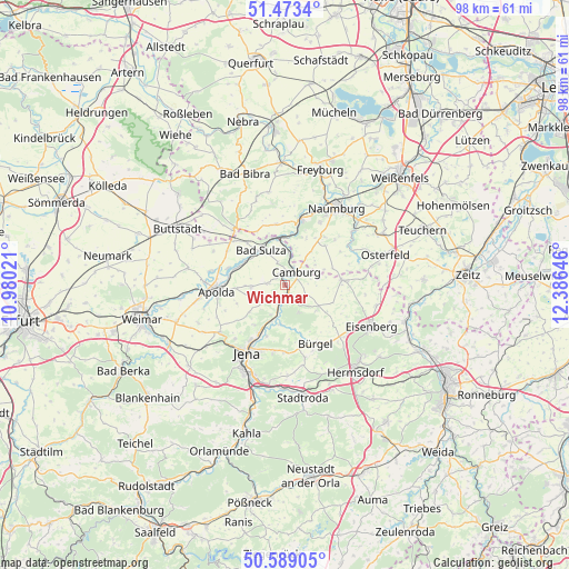
Wichmar GPS coordinates[2]
51° 1' 59.988" North, 11° 40' 59.988" East
| Map corner | latitude | longitude |
|---|---|---|
| Upper-left | 51.4734°, | 10.98021° |
| Center: | 51.03333°, | 11.68333° |
| Lower-right: | 50.58905°, | 12.38646° |
| Map W x H: | 98.3×98.3 km | = 61.1×61.1mi |
| max Lat: | 55.01917° ⇑41.4% North |
| Wichmar: | 51.03333° |
| min Lat: | ⇓58.6% South 47.40724° |
| min Long | Wichmar | max Long |
| 5.92978° | 11.68333° | 14.98853° |
| W 76.9%⇐ | ⇒23.1% E |
Elevation
Elevation of Wichmar is 134 m = 440 ft, and this is 115.1 m = 378 ft below average elevation for this country.
| Max E: |
1256 m = 4121 ft | 62.7% |
| Avg. | 249.1 m = 817 ft | |
| Wichmar | 134 m = 440 ft | |
Min E: |
-5 m = -16 ft | 37.3% |
See also: Germany elevation on elevation.city.
Geographical zone
Wichmar is located in North temperate zone (between Tropic of Cancer and the Arctic Circle). Distance of this North polar circle is 1726.8 km =1073 mi to North.| Distance of | km | miles | from Wichmar |
|---|---|---|---|
| North Pole | 4332.7 | 2692.2 | to North |
| Arctic Circle | 1726.8 | 1073 | to North |
| Tropic Cancer | 3068.5 | 1906.7 | to South |
| Equator | 5674.4 | 3525.9 | to South |


Nearby cities:
15 places around Wichmar: (largest is in red/bold)
• Bad Sulza
7.4 km =4.6 mi,  326°
326°
• Camburg
3.1 km =1.9 mi,  37°
37°
• Dornburg
3.2 km =2 mi,  205°
205°
• Frauenprießnitz
4 km =2.5 mi,  117°
117°
• Golmsdorf
7.5 km =4.7 mi,  188°
188°
• Großheringen
7.8 km =4.8 mi,  352°
352°
• Hainichen
6 km =3.7 mi,  231°
231°
• Löberschütz
7.5 km =4.7 mi,  171°
171°
• Mertendorf
7.9 km =4.9 mi, 117°
• Molau
7.2 km =4.5 mi,  67°
67°
• Neuengönna
6 km =3.7 mi,  202°
202°
• Schmiedehausen
3.9 km =2.4 mi,  342°
342°
• Tautenburg
4.4 km =2.7 mi,  147°
147°
• Thierschneck
5.8 km =3.6 mi,  90°
90°
• Zimmern
5.1 km =3.2 mi,  223°
223°
Sources, notices
• [Note1] Compared only with cities in Germany existing in our database
• [Src1] Map data: © OpenStreetMap contributors (CC-BY-SA)
• [Src2] Other city data from geonames.org with taken over terms of usage.
• [Src3] Geographical zone / Annual Mean Temperature by Robert A. Rohde @ Wikipedia
