Molau geodata
Molau (Saxony-Anhalt) is a populated place; located in Germany in Europe/Berlin (GMT+2) time zone. With population of 560 people, there are 9028 cities with bigger population in this country. Compared to other cities in Germany, 59.1% of cities are located further ↓South; 78.5% of cities are located further ←West and 55.9% of cities have lower elevation than Molau. Note1


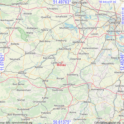
Molau GPS coordinates[2]
51° 3' 28.08" North, 11° 46' 45.588" East
| Map corner | latitude | longitude |
|---|---|---|
| Upper-left | 51.49763°, | 11.07621° |
| Center: | 51.0578°, | 11.77933° |
| Lower-right: | 50.61375°, | 12.48246° |
| Map W x H: | 98.3×98.3 km | = 61.1×61.1mi |
| max Lat: | 55.01917° ⇑40.9% North |
| Molau: | 51.0578° |
| min Lat: | ⇓59.1% South 47.40724° |
| min Long | Molau | max Long |
| 5.92978° | 11.77933° | 14.98853° |
| W 78.5%⇐ | ⇒21.5% E |
Elevation
Elevation of Molau is 265 m = 869 ft, and this is 15.9 m = 52 ft above average elevation for this country.
| Max E: |
1256 m = 4121 ft | 44.1% |
| Molau | 265 m 869 ft | |
| Avg. | 249.1 m = 817 ft | |
Min E: |
-5 m = -16 ft | 55.9% |
See also: Germany elevation on elevation.city.
Geographical zone
Molau is located in North temperate zone (between Tropic of Cancer and the Arctic Circle). Distance of this North polar circle is 1724.1 km =1071.3 mi to North.| Distance of | km | miles | from Molau |
|---|---|---|---|
| North Pole | 4330 | 2690.5 | to North |
| Arctic Circle | 1724.1 | 1071.3 | to North |
| Tropic Cancer | 3071.2 | 1908.4 | to South |
| Equator | 5677.1 | 3527.6 | to South |


Nearby cities:
15 places around Molau: (largest is in red/bold)
• Bad Kösen
9.4 km =5.8 mi,  334°
334°
• Camburg
4.9 km =3 mi,  266°
266°
• Dornburg
9.9 km =6.2 mi,  235°
235°
• Frauenprießnitz
5.6 km =3.5 mi,  215°
215°
• Großheringen
9.2 km =5.7 mi,  303°
303°
• Gösen
9.7 km =6 mi,  131°
131°
• Lengefeld
8 km =5 mi,  324°
324°
• Mertendorf
6.4 km =4 mi,  177°
177°
• Mertendorf
8.7 km =5.4 mi,  39°
39°
• Petersberg
9.1 km =5.7 mi,  155°
155°
• Schkölen
3.4 km =2.1 mi,  121°
121°
• Schmiedehausen
7.9 km =4.9 mi,  277°
277°
• Tautenburg
7.8 km =4.8 mi,  214°
214°
• Thierschneck
2.9 km =1.8 mi,  198°
198°
• Wichmar
7.2 km =4.5 mi,  247°
247°
Sources, notices
• [Note1] Compared only with cities in Germany existing in our database
• [Src1] Map data: © OpenStreetMap contributors (CC-BY-SA)
• [Src2] Other city data from geonames.org with taken over terms of usage.
• [Src3] Geographical zone / Annual Mean Temperature by Robert A. Rohde @ Wikipedia
