Weisen geodata
Weisen (Brandenburg) is a seat of a fourth-order administrative division; located in Germany in Europe/Berlin (GMT+2) time zone. With population of 1,103 people, there are 6837 cities with bigger population in this country. Compared to other cities in Germany, 81.9% of cities are located further ↓South; 78.6% of cities are located further ←West and 88.9% of cities have higher elevation than Weisen. Note1


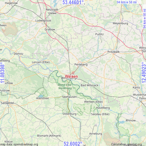
Weisen GPS coordinates[2]
53° 1' 30.648" North, 11° 47' 13.56" East
| Map corner | latitude | longitude |
|---|---|---|
| Upper-left | 53.44601°, | 11.08398° |
| Center: | 53.02518°, | 11.7871° |
| Lower-right: | 52.6002°, | 12.49023° |
| Map W x H: | 94×94 km | = 58.4×58.4mi |
| max Lat: | 55.01917° ⇑18.1% North |
| Weisen: | 53.02518° |
| min Lat: | ⇓81.9% South 47.40724° |
| min Long | Weisen | max Long |
| 5.92978° | 11.7871° | 14.98853° |
| W 78.6%⇐ | ⇒21.4% E |
Elevation
Elevation of Weisen is 24 m = 79 ft, and this is 225.1 m = 739 ft below average elevation for this country.
| Max E: |
1256 m = 4121 ft | 88.9% |
| Avg. | 249.1 m = 817 ft | |
| Weisen | 24 m = 79 ft | |
Min E: |
-5 m = -16 ft | 11.1% |
See also: Germany elevation on elevation.city.
Geographical zone
Weisen is located in North temperate zone (between Tropic of Cancer and the Arctic Circle). Distance of this North polar circle is 1505.3 km =935.3 mi to North.| Distance of | km | miles | from Weisen |
|---|---|---|---|
| North Pole | 4111.2 | 2554.6 | to North |
| Arctic Circle | 1505.3 | 935.3 | to North |
| Tropic Cancer | 3289.9 | 2044.2 | to South |
| Equator | 5895.8 | 3663.5 | to South |


Nearby cities:
15 places around Weisen: (largest is in red/bold)
• Bad Wilsnack
13.3 km =8.3 mi,  125°
125°
• Beuster
9.5 km =5.9 mi,  180°
180°
• Breese
2.9 km =1.8 mi,  162°
162°
• Cumlosen
8.1 km =5 mi,  276°
276°
• Groß Garz
15.6 km =9.7 mi,  229°
229°
• Karstädt
15.5 km =9.6 mi,  348°
348°
• Krüden
12.8 km =8 mi,  207°
207°
• Lanz
13.7 km =8.5 mi,  293°
293°
• Legde
16.7 km =10.4 mi,  135°
135°
• Perleberg
7.3 km =4.5 mi,  39°
39°
• Rühstädt
13.2 km =8.2 mi, 156°
• Schnackenburg
14.9 km =9.3 mi, 275°
• Schönberg
16.3 km =10.1 mi,  171°
171°
• Seehausen
15.4 km =9.6 mi,  188°
188°
• Wittenberge
3.3 km =2.1 mi, 228°
Sources, notices
• [Note1] Compared only with cities in Germany existing in our database
• [Src1] Map data: © OpenStreetMap contributors (CC-BY-SA)
• [Src2] Other city data from geonames.org with taken over terms of usage.
• [Src3] Geographical zone / Annual Mean Temperature by Robert A. Rohde @ Wikipedia
