Wasserthaleben geodata
Wasserthaleben (Thuringia) is a seat of a fourth-order administrative division; located in Germany in Europe/Berlin (GMT+2) time zone. With population of 476 people, there are 9455 cities with bigger population in this country. Compared to other cities in Germany, 62.3% of cities are located further ↓South; 65.2% of cities are located further ←West and 51.3% of cities have lower elevation than Wasserthaleben. Note1


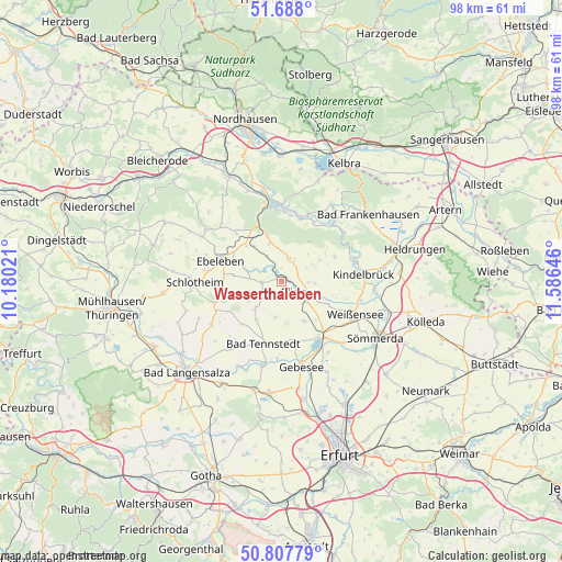
Wasserthaleben GPS coordinates[2]
51° 15' 0" North, 10° 52' 59.988" East
| Map corner | latitude | longitude |
|---|---|---|
| Upper-left | 51.688°, | 10.18021° |
| Center: | 51.25°, | 10.88333° |
| Lower-right: | 50.80779°, | 11.58646° |
| Map W x H: | 97.9×97.9 km | = 60.8×60.8mi |
| max Lat: | 55.01917° ⇑37.7% North |
| Wasserthaleben: | 51.25° |
| min Lat: | ⇓62.3% South 47.40724° |
| min Long | Wasserthaleben | max Long |
| 5.92978° | 10.88333° | 14.98853° |
| W 65.2%⇐ | ⇒34.8% E |
Elevation
Elevation of Wasserthaleben is 235 m = 771 ft, and this is 14.1 m = 46 ft below average elevation for this country.
| Max E: |
1256 m = 4121 ft | 48.7% |
| Avg. | 249.1 m = 817 ft | |
| Wasserthaleben | 235 m = 771 ft | |
Min E: |
-5 m = -16 ft | 51.3% |
See also: Germany elevation on elevation.city.
Geographical zone
Wasserthaleben is located in North temperate zone (between Tropic of Cancer and the Arctic Circle). Distance of this North polar circle is 1702.7 km =1058 mi to North.| Distance of | km | miles | from Wasserthaleben |
|---|---|---|---|
| North Pole | 4308.6 | 2677.2 | to North |
| Arctic Circle | 1702.7 | 1058 | to North |
| Tropic Cancer | 3092.5 | 1921.6 | to South |
| Equator | 5698.5 | 3540.9 | to South |


Nearby cities:
15 places around Wasserthaleben: (largest is in red/bold)
• Abtsbessingen
8.5 km =5.3 mi,  278°
278°
• Bellstedt
7.2 km =4.5 mi, 284°
• Clingen
4 km =2.5 mi,  120°
120°
• Freienbessingen
8.3 km =5.2 mi,  257°
257°
• Gangloffsömmern
7.9 km =4.9 mi,  148°
148°
• Greußen
4.8 km =3 mi, 118°
• Großenehrich
3.4 km =2.1 mi,  266°
266°
• Hornsömmern
5.9 km =3.7 mi,  231°
231°
• Mittelsömmern
7.2 km =4.5 mi,  219°
219°
• Niederbösa
8.3 km =5.2 mi,  77°
77°
• Thüringenhausen
6.1 km =3.8 mi,  287°
287°
• Topfstedt
6.1 km =3.8 mi,  72°
72°
• Trebra
7.9 km =4.9 mi,  61°
61°
• Westgreußen
2.8 km =1.7 mi, 116°
• Wolferschwenda
6.1 km =3.8 mi,  252°
252°
Sources, notices
• [Note1] Compared only with cities in Germany existing in our database
• [Src1] Map data: © OpenStreetMap contributors (CC-BY-SA)
• [Src2] Other city data from geonames.org with taken over terms of usage.
• [Src3] Geographical zone / Annual Mean Temperature by Robert A. Rohde @ Wikipedia
