Greußen geodata
Greußen (Thuringia) is a populated place; located in Germany in Europe/Berlin (GMT+2) time zone. With population of 3,962 people, there are 3322 cities with bigger population in this country. Compared to other cities in Germany, 62% of cities are located further ↓South; 66.2% of cities are located further ←West and 58.8% of cities have higher elevation than Greußen. Note1


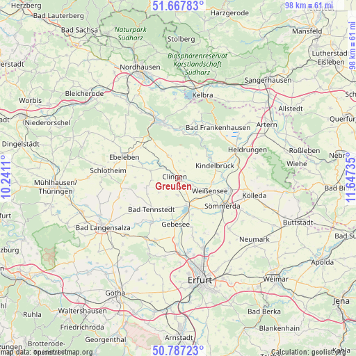
Greußen GPS coordinates[2]
51° 13' 46.704" North, 10° 56' 39.192" East
| Map corner | latitude | longitude |
|---|---|---|
| Upper-left | 51.66783°, | 10.2411° |
| Center: | 51.22964°, | 10.94422° |
| Lower-right: | 50.78723°, | 11.64735° |
| Map W x H: | 97.9×97.9 km | = 60.8×60.8mi |
| max Lat: | 55.01917° ⇑38% North |
| Greußen: | 51.22964° |
| min Lat: | ⇓62% South 47.40724° |
| min Long | Greußen | max Long |
| 5.92978° | 10.94422° | 14.98853° |
| W 66.2%⇐ | ⇒33.8% E |
Elevation
Elevation of Greußen is 162 m = 531 ft, and this is 87.1 m = 286 ft below average elevation for this country.
| Max E: |
1256 m = 4121 ft | 58.8% |
| Avg. | 249.1 m = 817 ft | |
| Greußen | 162 m = 531 ft | |
Min E: |
-5 m = -16 ft | 41.2% |
See also: Germany elevation on elevation.city.
Geographical zone
Greußen is located in North temperate zone (between Tropic of Cancer and the Arctic Circle). Distance of this North polar circle is 1705 km =1059.4 mi to North.| Distance of | km | miles | from Greußen |
|---|---|---|---|
| North Pole | 4310.9 | 2678.7 | to North |
| Arctic Circle | 1705 | 1059.4 | to North |
| Tropic Cancer | 3090.3 | 1920.2 | to South |
| Equator | 5696.2 | 3539.5 | to South |


Nearby cities:
15 places around Greußen: (largest is in red/bold)
• Clingen
0.8 km =0.5 mi,  288°
288°
• Frömmstedt
7.5 km =4.7 mi,  62°
62°
• Gangloffsömmern
4.5 km =2.8 mi,  180°
180°
• Großenehrich
7.9 km =4.9 mi, 285°
• Herrnschwende
4.1 km =2.5 mi,  110°
110°
• Hornsömmern
9 km =5.6 mi,  260°
260°
• Niederbösa
5.7 km =3.5 mi,  43°
43°
• Oberbösa
8.3 km =5.2 mi, 37°
• Schwerstedt
8.4 km =5.2 mi,  191°
191°
• Straußfurt
7.5 km =4.7 mi,  158°
158°
• Topfstedt
4.4 km =2.7 mi,  20°
20°
• Trebra
6.6 km =4.1 mi, 24°
• Wasserthaleben
4.8 km =3 mi,  298°
298°
• Weißensee
9.3 km =5.8 mi, 110°
• Westgreußen
2 km =1.2 mi, 300°
Sources, notices
• [Note1] Compared only with cities in Germany existing in our database
• [Src1] Map data: © OpenStreetMap contributors (CC-BY-SA)
• [Src2] Other city data from geonames.org with taken over terms of usage.
• [Src3] Geographical zone / Annual Mean Temperature by Robert A. Rohde @ Wikipedia
