Großenehrich geodata
Großenehrich (Thuringia) is a seat of a fourth-order administrative division; located in Germany in Europe/Berlin (GMT+2) time zone. With population of 2,482 people, there are 4461 cities with bigger population in this country. Compared to other cities in Germany, 62.3% of cities are located further ↓South; 64.6% of cities are located further ←West and 53.2% of cities have lower elevation than Großenehrich. Note1


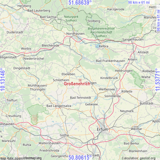
Großenehrich GPS coordinates[2]
51° 14' 54.168" North, 10° 50' 4.488" East
| Map corner | latitude | longitude |
|---|---|---|
| Upper-left | 51.68639°, | 10.13146° |
| Center: | 51.24838°, | 10.83458° |
| Lower-right: | 50.80615°, | 11.53771° |
| Map W x H: | 97.9×97.9 km | = 60.8×60.8mi |
| max Lat: | 55.01917° ⇑37.7% North |
| Großenehrich: | 51.24838° |
| min Lat: | ⇓62.3% South 47.40724° |
| min Long | Großenehrich | max Long |
| 5.92978° | 10.83458° | 14.98853° |
| W 64.6%⇐ | ⇒35.4% E |
Elevation
Elevation of Großenehrich is 248 m = 814 ft, and this is 1.1 m = 4 ft below average elevation for this country.
| Max E: |
1256 m = 4121 ft | 46.8% |
| Avg. | 249.1 m = 817 ft | |
| Großenehrich | 248 m = 814 ft | |
Min E: |
-5 m = -16 ft | 53.2% |
See also: Germany elevation on elevation.city.
Geographical zone
Großenehrich is located in North temperate zone (between Tropic of Cancer and the Arctic Circle). Distance of this North polar circle is 1702.9 km =1058.1 mi to North.| Distance of | km | miles | from Großenehrich |
|---|---|---|---|
| North Pole | 4308.8 | 2677.4 | to North |
| Arctic Circle | 1702.9 | 1058.1 | to North |
| Tropic Cancer | 3092.4 | 1921.5 | to South |
| Equator | 5698.3 | 3540.8 | to South |


Nearby cities:
15 places around Großenehrich: (largest is in red/bold)
• Abtsbessingen
5.2 km =3.2 mi,  286°
286°
• Bellstedt
4.1 km =2.5 mi,  299°
299°
• Blankenburg
8 km =5 mi,  227°
227°
• Clingen
7.1 km =4.4 mi,  104°
104°
• Freienbessingen
5 km =3.1 mi,  250°
250°
• Greußen
7.9 km =4.9 mi,  105°
105°
• Haussömmern
7.3 km =4.5 mi,  189°
189°
• Hornsömmern
3.7 km =2.3 mi,  199°
199°
• Kutzleben
8 km =5 mi, 227°
• Mittelsömmern
5.5 km =3.4 mi, 193°
• Rockstedt
6.5 km =4 mi,  308°
308°
• Thüringenhausen
3.2 km =2 mi, 310°
• Wasserthaleben
3.4 km =2.1 mi,  86°
86°
• Westgreußen
6 km =3.7 mi, 100°
• Wolferschwenda
2.9 km =1.8 mi,  235°
235°
Sources, notices
• [Note1] Compared only with cities in Germany existing in our database
• [Src1] Map data: © OpenStreetMap contributors (CC-BY-SA)
• [Src2] Other city data from geonames.org with taken over terms of usage.
• [Src3] Geographical zone / Annual Mean Temperature by Robert A. Rohde @ Wikipedia
