Warmensteinach geodata
Warmensteinach (Bavaria) is a seat of a fourth-order administrative division; located in Germany in Europe/Berlin (GMT+2) time zone. With population of 2,379 people, there are 4578 cities with bigger population in this country. Compared to other cities in Germany, 63.9% of cities are located further ↑North; 78.5% of cities are located further ←West and 92.7% of cities have lower elevation than Warmensteinach. Note1
Administrative division(s):
- Level 1: Bavaria
- Level 2: Upper Franconia
- Level 3: Landkreis Bayreuth
- Level 4: Warmensteinach


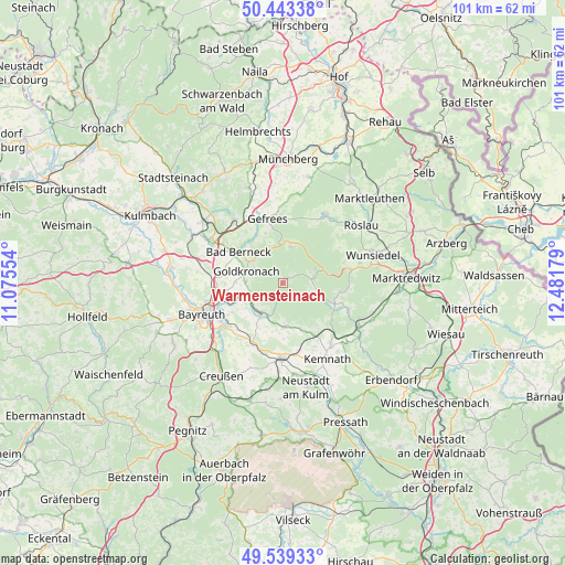
Warmensteinach GPS coordinates[2]
49° 59' 36.528" North, 11° 46' 43.176" East
| Map corner | latitude | longitude |
|---|---|---|
| Upper-left | 50.44338°, | 11.07554° |
| Center: | 49.99348°, | 11.77866° |
| Lower-right: | 49.53933°, | 12.48179° |
| Map W x H: | 100.5×100.5 km | = 62.4×62.4mi |
| max Lat: | 55.01917° ⇑63.9% North |
| Warmensteinach: | 49.99348° |
| min Lat: | ⇓36.1% South 47.40724° |
| min Long | Warmensteinach | max Long |
| 5.92978° | 11.77866° | 14.98853° |
| W 78.5%⇐ | ⇒21.5% E |
Elevation
Elevation of Warmensteinach is 553 m = 1814 ft, and this is 303.9 m = 997 ft above average elevation for this country.
| Max E: |
1256 m = 4121 ft | 7.3% |
| Warmensteinach | 553 m 1814 ft | |
| Avg. | 249.1 m = 817 ft | |
Min E: |
-5 m = -16 ft | 92.7% |
See also: Germany elevation on elevation.city.
Geographical zone
Warmensteinach is located in North temperate zone (between Tropic of Cancer and the Arctic Circle). Distance of this North polar circle is 1842.4 km =1144.8 mi to North.| Distance of | km | miles | from Warmensteinach |
|---|---|---|---|
| North Pole | 4448.3 | 2764 | to North |
| Arctic Circle | 1842.4 | 1144.8 | to North |
| Tropic Cancer | 2952.8 | 1834.8 | to South |
| Equator | 5558.8 | 3454.1 | to South |


Nearby cities:
15 places around Warmensteinach: (largest is in red/bold)
• Bad Berneck im Fichtelgebirge
9.6 km =6 mi,  307°
307°
• Bindlach
11.9 km =7.4 mi,  263°
263°
• Bischofsgrün
6.6 km =4.1 mi,  13°
13°
• Brand
10.2 km =6.3 mi,  111°
111°
• Ebnath
12.1 km =7.5 mi, 113°
• Fichtelberg
5.5 km =3.4 mi,  79°
79°
• Gefrees
11.7 km =7.3 mi,  345°
345°
• Gesees
9.1 km =5.7 mi,  298°
298°
• Goldkronach
6.8 km =4.2 mi,  286°
286°
• Immenreuth
12.2 km =7.6 mi,  148°
148°
• Kirchenpingarten
6.7 km =4.2 mi,  177°
177°
• Mehlmeisel
6.3 km =3.9 mi, 109°
• Nagel
9.9 km =6.2 mi,  96°
96°
• Plößberg
10.4 km =6.5 mi,  141°
141°
• Reuth
6 km =3.7 mi,  266°
266°
Sources, notices
• [Note1] Compared only with cities in Germany existing in our database
• [Src1] Map data: © OpenStreetMap contributors (CC-BY-SA)
• [Src2] Other city data from geonames.org with taken over terms of usage.
• [Src3] Geographical zone / Annual Mean Temperature by Robert A. Rohde @ Wikipedia
