Wangen geodata
Wangen (Baden-Württemberg) is a seat of a fourth-order administrative division; located in Germany in Europe/Berlin (GMT+2) time zone. With population of 3,209 people, there are 3820 cities with bigger population in this country. Compared to other cities in Germany, 86.1% of cities are located further ↑North; 56% of cities are located further →East and 73% of cities have lower elevation than Wangen. Note1
Administrative division(s):
- Level 1: Baden-Württemberg
- Level 2: Regierungsbezirk Stuttgart
- Level 3: Landkreis Göppingen
- Level 4: Wangen


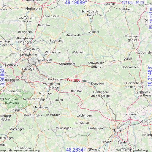
Wangen GPS coordinates[2]
48° 43' 45.588" North, 9° 36' 42.3" East
| Map corner | latitude | longitude |
|---|---|---|
| Upper-left | 49.19099°, | 8.90863° |
| Center: | 48.72933°, | 9.61175° |
| Lower-right: | 48.2634°, | 10.31488° |
| Map W x H: | 103.1×103.1 km | = 64.1×64.1mi |
| max Lat: | 55.01917° ⇑86.1% North |
| Wangen: | 48.72933° |
| min Lat: | ⇓13.9% South 47.40724° |
| min Long | Wangen | max Long |
| 5.92978° | 9.61175° | 14.98853° |
| W 44%⇐ | ⇒56% E |
Elevation
Elevation of Wangen is 382 m = 1253 ft, and this is 132.9 m = 436 ft above average elevation for this country.
| Max E: |
1256 m = 4121 ft | 27% |
| Wangen | 382 m 1253 ft | |
| Avg. | 249.1 m = 817 ft | |
Min E: |
-5 m = -16 ft | 73% |
See also: Germany elevation on elevation.city.
Geographical zone
Wangen is located in North temperate zone (between Tropic of Cancer and the Arctic Circle). Distance of this North polar circle is 1983 km =1232.2 mi to North.| Distance of | km | miles | from Wangen |
|---|---|---|---|
| North Pole | 4588.9 | 2851.4 | to North |
| Arctic Circle | 1983 | 1232.2 | to North |
| Tropic Cancer | 2812.3 | 1747.5 | to South |
| Equator | 5418.2 | 3366.7 | to South |


Nearby cities:
15 places around Wangen: (largest is in red/bold)
• Adelberg
3.8 km =2.4 mi,  346°
346°
• Albershausen
5.4 km =3.4 mi,  219°
219°
• Birenbach
4.1 km =2.5 mi,  61°
61°
• Börtlingen
3.1 km =1.9 mi,  28°
28°
• Ebersbach an der Fils
6.6 km =4.1 mi,  257°
257°
• Eislingen
7.9 km =4.9 mi,  118°
118°
• Göppingen
4.1 km =2.5 mi,  134°
134°
• Hattenhofen
7.5 km =4.7 mi,  201°
201°
• Heiningen
8 km =5 mi,  159°
159°
• Plüderhausen
7.8 km =4.8 mi, 351°
• Rechberghausen
2.4 km =1.5 mi,  86°
86°
• Schlierbach
9.3 km =5.8 mi,  227°
227°
• Uhingen
3.3 km =2.1 mi,  214°
214°
• Wäschenbeuren
6.5 km =4 mi, 58°
• Zell unter Aichelberg
9.4 km =5.8 mi, 198°
Sources, notices
• [Note1] Compared only with cities in Germany existing in our database
• [Src1] Map data: © OpenStreetMap contributors (CC-BY-SA)
• [Src2] Other city data from geonames.org with taken over terms of usage.
• [Src3] Geographical zone / Annual Mean Temperature by Robert A. Rohde @ Wikipedia
