Wachenheim geodata
Wachenheim (Rheinland-Pfalz) is a populated place; located in Germany in Europe/Berlin (GMT+2) time zone. With population of 644 people, there are 8586 cities with bigger population in this country. Compared to other cities in Germany, 72.8% of cities are located further ↑North; 74.6% of cities are located further →East and 59.1% of cities have higher elevation than Wachenheim. Note1
Administrative division(s):
- Level 1: Rheinland-Pfalz
- Level 3: Landkreis Alzey-Worms
- Level 4: Monsheim


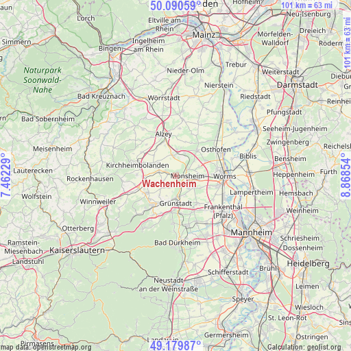
Wachenheim GPS coordinates[2]
49° 38' 14.496" North, 8° 9' 55.476" East
| Map corner | latitude | longitude |
|---|---|---|
| Upper-left | 50.09059°, | 7.46229° |
| Center: | 49.63736°, | 8.16541° |
| Lower-right: | 49.17987°, | 8.86854° |
| Map W x H: | 101.3×101.3 km | = 62.9×62.9mi |
| max Lat: | 55.01917° ⇑72.8% North |
| Wachenheim: | 49.63736° |
| min Lat: | ⇓27.2% South 47.40724° |
| min Long | Wachenheim | max Long |
| 5.92978° | 8.16541° | 14.98853° |
| W 25.4%⇐ | ⇒74.6% E |
Elevation
Elevation of Wachenheim is 160 m = 525 ft, and this is 89.1 m = 292 ft below average elevation for this country.
| Max E: |
1256 m = 4121 ft | 59.1% |
| Avg. | 249.1 m = 817 ft | |
| Wachenheim | 160 m = 525 ft | |
Min E: |
-5 m = -16 ft | 40.9% |
See also: Germany elevation on elevation.city.
Geographical zone
Wachenheim is located in North temperate zone (between Tropic of Cancer and the Arctic Circle). Distance of this North polar circle is 1882 km =1169.4 mi to North.| Distance of | km | miles | from Wachenheim |
|---|---|---|---|
| North Pole | 4487.9 | 2788.7 | to North |
| Arctic Circle | 1882 | 1169.4 | to North |
| Tropic Cancer | 2913.2 | 1810.2 | to South |
| Equator | 5519.2 | 3429.5 | to South |


Nearby cities:
15 places around Wachenheim: (largest is in red/bold)
• Albisheim
5.3 km =3.3 mi,  284°
284°
• Biedesheim
5.5 km =3.4 mi,  229°
229°
• Bockenheim
3.7 km =2.3 mi,  157°
157°
• Bubenheim
3.6 km =2.2 mi,  253°
253°
• Einselthum
3.3 km =2.1 mi,  298°
298°
• Flomborn
6 km =3.7 mi,  348°
348°
• Hohen-Sülzen
4.8 km =3 mi,  115°
115°
• Immesheim
4.3 km =2.7 mi,  268°
268°
• Kindenheim
2.9 km =1.8 mi,  181°
181°
• Monsheim
3.4 km =2.1 mi,  90°
90°
• Mölsheim
1.1 km =0.7 mi,  15°
15°
• Ober-Flörsheim
5.1 km =3.2 mi, 351°
• Obrigheim
5.8 km =3.6 mi,  150°
150°
• Ottersheim
4.3 km =2.7 mi, 252°
• Rüssingen
6 km =3.7 mi, 246°
Sources, notices
• [Note1] Compared only with cities in Germany existing in our database
• [Src1] Map data: © OpenStreetMap contributors (CC-BY-SA)
• [Src2] Other city data from geonames.org with taken over terms of usage.
• [Src3] Geographical zone / Annual Mean Temperature by Robert A. Rohde @ Wikipedia
