Kuchelmiß geodata
Kuchelmiß (Mecklenburg-Vorpommern) is a populated place; located in Germany in Europe/Berlin (GMT+2) time zone. With population of 938 people, there are 7395 cities with bigger population in this country. Compared to other cities in Germany, 88.2% of cities are located further ↓South; 86.5% of cities are located further ←West and 81.4% of cities have higher elevation than Kuchelmiß. Note1
Administrative division(s):
- Level 1: Mecklenburg-Vorpommern
- Level 3: Landkreis Rostock
- Level 4: Kuchelmiß


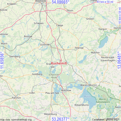
Kuchelmiß GPS coordinates[2]
53° 40' 56.172" North, 12° 21' 42.048" East
| Map corner | latitude | longitude |
|---|---|---|
| Upper-left | 54.09665°, | 11.65856° |
| Center: | 53.68227°, | 12.36168° |
| Lower-right: | 53.26377°, | 13.06481° |
| Map W x H: | 92.6×92.6 km | = 57.5×57.5mi |
| max Lat: | 55.01917° ⇑11.8% North |
| Kuchelmiß: | 53.68227° |
| min Lat: | ⇓88.2% South 47.40724° |
| min Long | Kuchelmiß | max Long |
| 5.92978° | 12.36168° | 14.98853° |
| W 86.5%⇐ | ⇒13.5% E |
Elevation
Elevation of Kuchelmiß is 43 m = 141 ft, and this is 206.1 m = 676 ft below average elevation for this country.
| Max E: |
1256 m = 4121 ft | 81.4% |
| Avg. | 249.1 m = 817 ft | |
| Kuchelmiß | 43 m = 141 ft | |
Min E: |
-5 m = -16 ft | 18.6% |
See also: Germany elevation on elevation.city.
Geographical zone
Kuchelmiß is located in North temperate zone (between Tropic of Cancer and the Arctic Circle). Distance of this North polar circle is 1432.3 km =890 mi to North.| Distance of | km | miles | from Kuchelmiß |
|---|---|---|---|
| North Pole | 4038.2 | 2509.2 | to North |
| Arctic Circle | 1432.3 | 890 | to North |
| Tropic Cancer | 3363 | 2089.7 | to South |
| Equator | 5968.9 | 3708.9 | to South |


Nearby cities:
15 places around Kuchelmiß: (largest is in red/bold)
• Dahmen
14.7 km =9.1 mi,  99°
99°
• Groß Roge
14.2 km =8.8 mi,  41°
41°
• Groß Wokern
11.5 km =7.1 mi,  48°
48°
• Hohen Wangelin
8.9 km =5.5 mi,  152°
152°
• Hoppenrade
7.7 km =4.8 mi,  310°
310°
• Krakow am See
6.9 km =4.3 mi,  240°
240°
• Lalendorf
8.6 km =5.3 mi,  12°
12°
• Langhagen
4.9 km =3 mi,  84°
84°
• Lüdershagen
7.7 km =4.8 mi,  302°
302°
• Mühl Rosin
13.3 km =8.3 mi, 313°
• Reimershagen
12.3 km =7.6 mi,  264°
264°
• Tessenow
15.3 km =9.5 mi, 78°
• Vollrathsruhe
9.4 km =5.8 mi,  117°
117°
• Wattmannshagen
10.8 km =6.7 mi,  15°
15°
• Zehna
15.2 km =9.4 mi,  284°
284°
Sources, notices
• [Note1] Compared only with cities in Germany existing in our database
• [Src1] Map data: © OpenStreetMap contributors (CC-BY-SA)
• [Src2] Other city data from geonames.org with taken over terms of usage.
• [Src3] Geographical zone / Annual Mean Temperature by Robert A. Rohde @ Wikipedia
