Vohenstrauß geodata
Vohenstrauß (Bavaria) is a populated place; located in Germany in Europe/Berlin (GMT+2) time zone. With population of 7,550 people, there are 2058 cities with bigger population in this country. Compared to other cities in Germany, 73.2% of cities are located further ↑North; 86.2% of cities are located further ←West and 92.7% of cities have lower elevation than Vohenstrauß. Note1
Administrative division(s):
- Level 1: Bavaria
- Level 2: Upper Palatinate
- Level 3: Landkreis Neustadt an der Waldnaab
- Level 4: Vohenstrauß


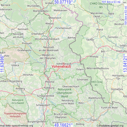
Vohenstrauß GPS coordinates[2]
49° 37' 25.788" North, 12° 20' 17.088" East
| Map corner | latitude | longitude |
|---|---|---|
| Upper-left | 50.07719°, | 11.63496° |
| Center: | 49.62383°, | 12.33808° |
| Lower-right: | 49.16621°, | 13.04121° |
| Map W x H: | 101.3×101.3 km | = 62.9×62.9mi |
| max Lat: | 55.01917° ⇑73.2% North |
| Vohenstrauß: | 49.62383° |
| min Lat: | ⇓26.8% South 47.40724° |
| min Long | Vohenstrauß | max Long |
| 5.92978° | 12.33808° | 14.98853° |
| W 86.2%⇐ | ⇒13.8% E |
Elevation
Elevation of Vohenstrauß is 553 m = 1814 ft, and this is 303.9 m = 997 ft above average elevation for this country.
| Max E: |
1256 m = 4121 ft | 7.3% |
| Vohenstrauß | 553 m 1814 ft | |
| Avg. | 249.1 m = 817 ft | |
Min E: |
-5 m = -16 ft | 92.7% |
See also: Germany elevation on elevation.city.
Geographical zone
Vohenstrauß is located in North temperate zone (between Tropic of Cancer and the Arctic Circle). Distance of this North polar circle is 1883.5 km =1170.4 mi to North.| Distance of | km | miles | from Vohenstrauß |
|---|---|---|---|
| North Pole | 4489.4 | 2789.6 | to North |
| Arctic Circle | 1883.5 | 1170.4 | to North |
| Tropic Cancer | 2911.7 | 1809.2 | to South |
| Equator | 5517.7 | 3428.5 | to South |


Nearby cities:
15 places around Vohenstrauß: (largest is in red/bold)
• Bechtsrieth
9.5 km =5.9 mi,  284°
284°
• Flossenbürg
12.2 km =7.6 mi,  4°
4°
• Floß
12 km =7.5 mi,  338°
338°
• Georgenberg
10.6 km =6.6 mi,  34°
34°
• Irchenrieth
8.1 km =5 mi,  269°
269°
• Leuchtenberg
6.5 km =4 mi,  242°
242°
• Moosbach
6.5 km =4 mi,  126°
126°
• Pirk
12.4 km =7.7 mi, 274°
• Pleystein
5.7 km =3.5 mi,  60°
60°
• Schirmitz
12.7 km =7.9 mi, 283°
• Theisseil
10.9 km =6.8 mi,  312°
312°
• Trausnitz
12.7 km =7.9 mi,  205°
205°
• Tännesberg
10.3 km =6.4 mi,  184°
184°
• Waidhaus
11.5 km =7.1 mi,  79°
79°
• Waldthurn
5.4 km =3.4 mi,  353°
353°
Sources, notices
• [Note1] Compared only with cities in Germany existing in our database
• [Src1] Map data: © OpenStreetMap contributors (CC-BY-SA)
• [Src2] Other city data from geonames.org with taken over terms of usage.
• [Src3] Geographical zone / Annual Mean Temperature by Robert A. Rohde @ Wikipedia
